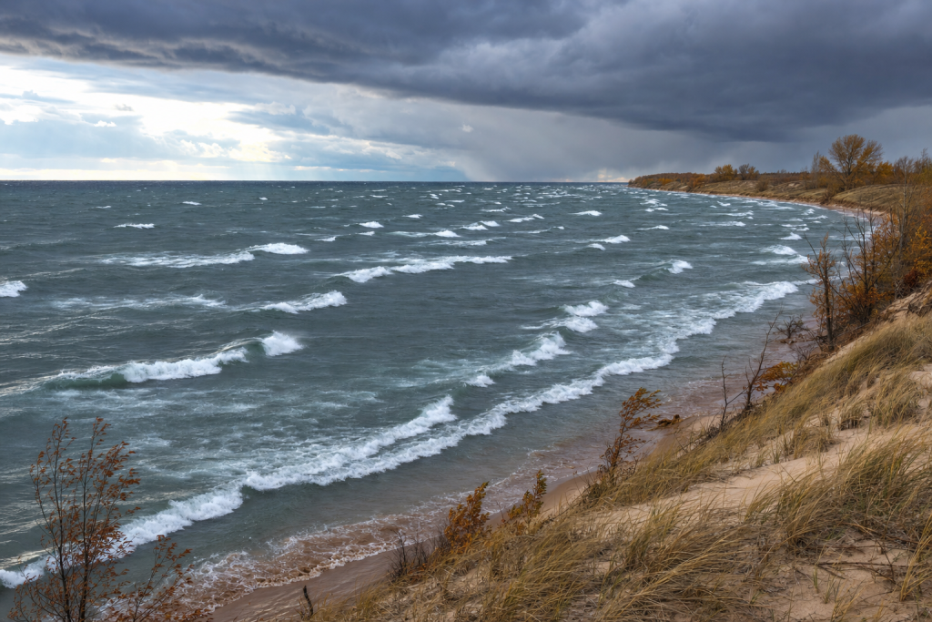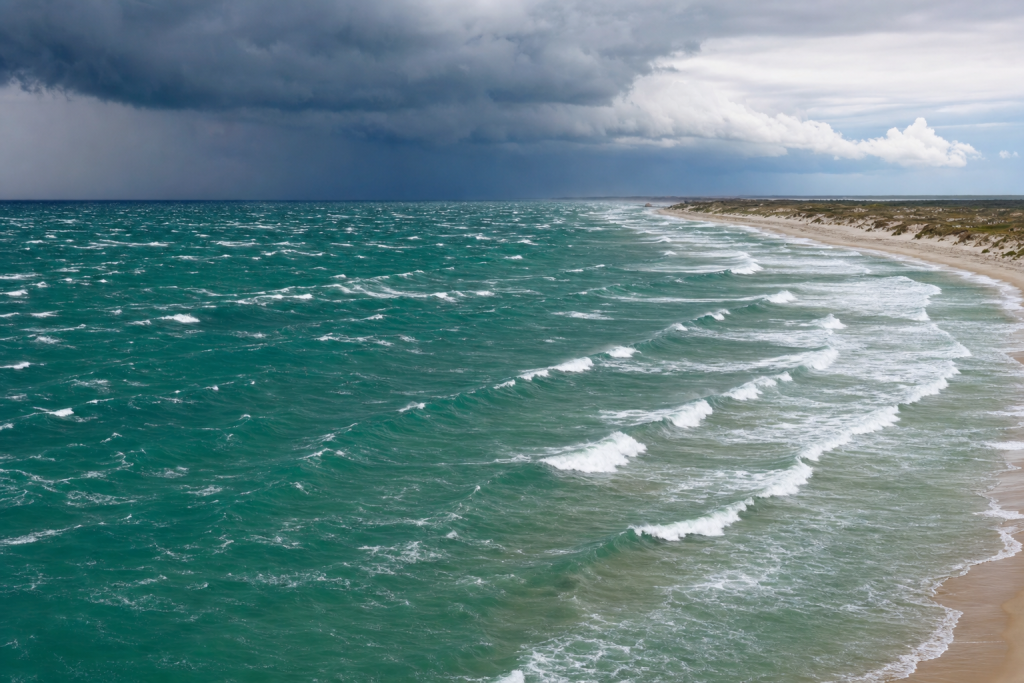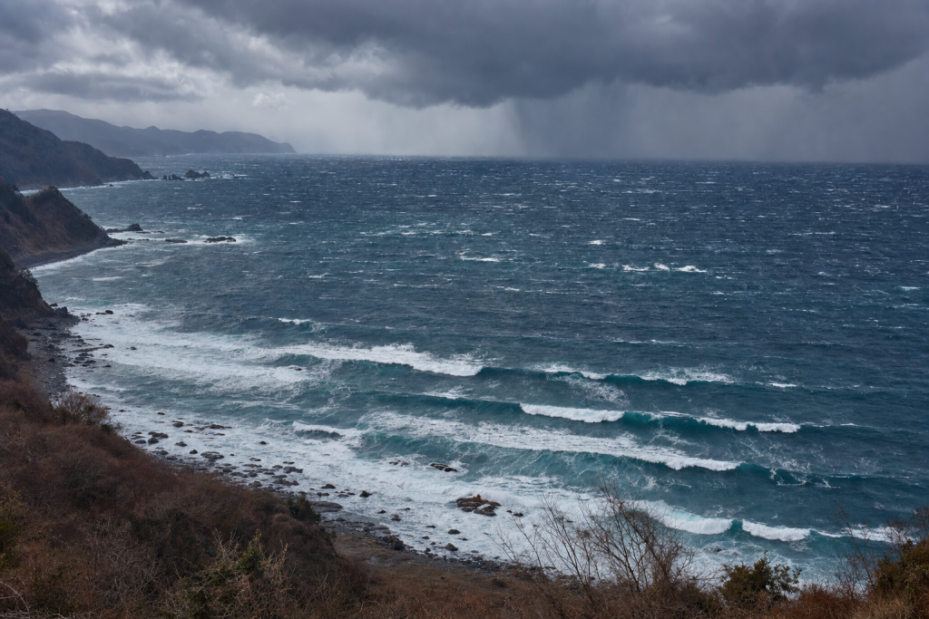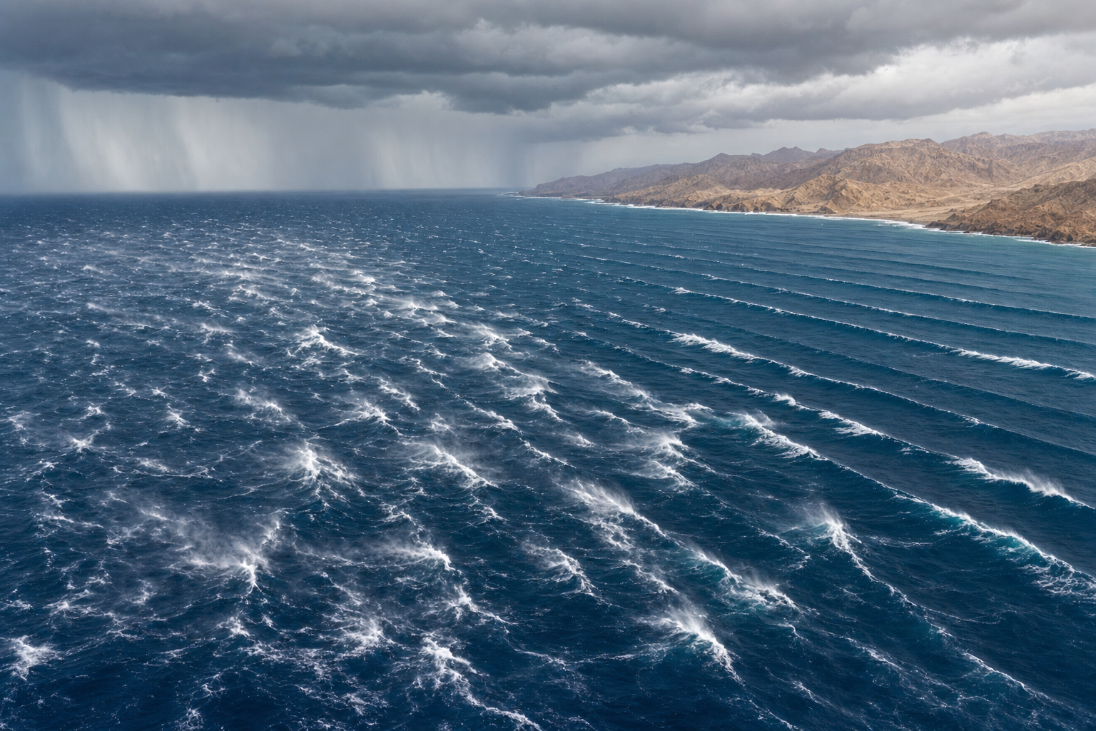
The Arabian Sea is one of the most seasonally dramatic swell basins in the world. For months it can be dominated by powerful southwest monsoon winds, then shift into cleaner but smaller winter surf, with the occasional tropical cyclone producing the kind of long-period swell that transforms exposed points, reefs, and beachbreaks. Understanding how waves are generated here means understanding monsoons, pressure gradients, tropical lows, and how each stretch of coastline is exposed to incoming swell. If you want to go deeper on the science behind it all, an introductory oceanography textbook can help fill in the gaps on wave physics and ocean circulation. For surf forecasting in the region, the key is not just spotting a storm on a map, but knowing whether its wind is strong enough, blowing long enough, and aimed at the coast you want to surf.
How Arabian Sea Waves Are Generated
Almost all surfable waves in the Arabian Sea begin with wind blowing over water. Wind transfers energy into the sea surface through friction. Small ripples become chop, chop becomes wind sea, and with enough wind strength and distance over open water, the waves organize into swell. If you want a practical breakdown of how to read and interpret these patterns, a surf forecasting guide can walk you through swell mechanics and how storms translate into waves at your local break.
Three ingredients matter most for wave generation in the Arabian Sea:
- Wind speed: Stronger wind pushes more energy into the ocean.
- Fetch: The longer the uninterrupted stretch of water under the wind, the larger the waves can become.
- Duration: A storm must blow long enough for the sea state to fully develop.
Direction is just as important. Waves travel away from the area of strongest wind, generally in the direction the wind is blowing. A 35-knot monsoon jet blowing from the southwest toward India can build large SW swell for India’s west coast, Pakistan, and parts of Oman. That same wind may do very little for a coastline tucked behind land or facing the wrong direction.
In the Arabian Sea, the most important wave makers are the southwest monsoon, tropical cyclones, winter shamal winds, northeast monsoon surges, and occasional long-period swell arriving from the southern Indian Ocean.
The Main Storm Types That Generate Arabian Sea Swell
Southwest Monsoon Swell
The southwest monsoon is the dominant swell engine of the Arabian Sea. It typically strengthens in June, peaks from July into August, and then weakens through September. It is driven by intense heating over India and Pakistan, which creates a broad low-pressure zone over the land. At the same time, high pressure over the southern Indian Ocean helps drive air across the equator. That flow bends under the influence of Earth’s rotation and becomes strong southwesterly wind across the Arabian Sea.
This wind field is broad and persistent. A jet of stronger wind, commonly called the Findlater Jet or Somali Jet, can blow at 25 to 40 knots for days on end. That sustained fetch stretches from the western Indian Ocean toward Oman, Pakistan, and India, generating consistent swell across the basin.
Typical southwest monsoon swell characteristics:
- Direction: Usually SSW, SW, or WSW depending on the coastline.
- Surf height: Commonly 4 to 10 feet on exposed coasts, with bigger days possible.
- Wave period: Often 8 to 12 seconds.
- Quality: Consistent but frequently raw, windy, and choppy near exposed beaches.
Monsoon waves are often not classic clean groundswell. Because the wind is active over a huge portion of the basin, the surf can be powerful but bumpy. Sheltered points, bays, and coastlines with some wind protection tend to handle monsoon swell far better than open beachbreaks.
Tropical Cyclone Swell
Tropical cyclones are the most powerful but least predictable swell producers in the Arabian Sea. They are most common before and after the southwest monsoon, particularly from May to early June and again from October into November. Peak monsoon months usually carry too much vertical wind shear for frequent cyclone development.
Cyclones need very warm sea surface temperatures, generally above 26.5°C, along with moist air and sufficient atmospheric rotation. Pre-monsoon and post-monsoon Arabian Sea temperatures can reach 28 to 31°C, giving developing lows a strong energy source. When upper-level winds are favorable, a tropical depression can intensify into a named cyclonic storm or even a severe cyclone.
Cyclone swell differs from monsoon swell because the strongest winds wrap around a compact low-pressure center. This can produce longer-period, more organized waves, especially if the storm moves slowly or tracks toward a coastline’s swell window.
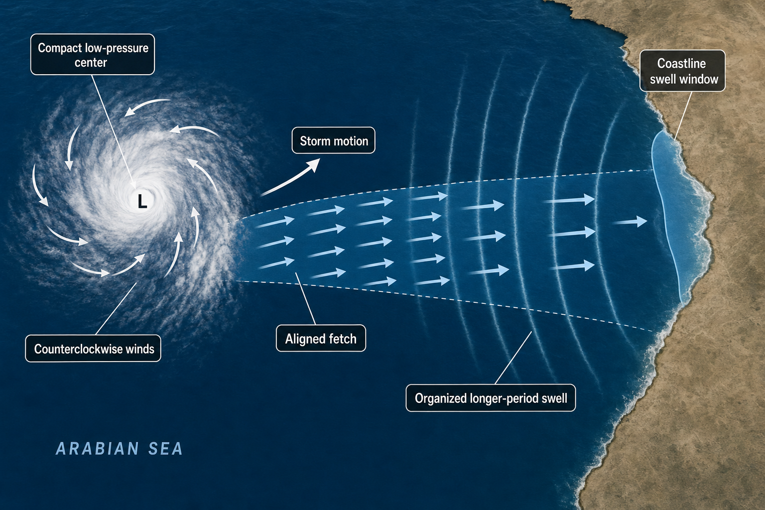
Typical cyclone swell characteristics:
- Direction: Highly variable, depending on where the cyclone forms and how it tracks.
- Surf height: Often 5 to 15 feet on exposed coasts during significant events.
- Wave period: Commonly 11 to 17 seconds, occasionally longer.
- Quality: Potentially excellent if the cyclone is distant and local winds are light.
A cyclone west of India can send strong WSW or SW swell to the Indian coast. A storm south or southeast of Oman can direct S or SE swell into Omani breaks. A cyclone tracking north through the central Arabian Sea can energize Pakistan, Gujarat, or the Makran coast depending on its exact position and track.
Winter Shamal Waves
Shamal winds are strong northwesterly winds associated with pressure gradients over the Arabian Peninsula, the Persian Gulf, and the northern Arabian Sea. They are most common in winter, though weaker shamal events can occur in summer as well.
A winter shamal typically develops when high pressure builds over Arabia, Iraq, or Iran while lower pressure sits to the east or southeast. The resulting wind can blow strongly down the Persian Gulf and into the Gulf of Oman. If the flow extends far enough into the open northern Arabian Sea, it can create short to mid-period surf on exposed breaks.
Typical shamal wave characteristics:
- Direction: NW, NNW, or WNW depending on the basin and coastline angle.
- Surf height: Usually 2 to 6 feet, with larger surf in the most exposed northern areas.
- Wave period: Often 6 to 9 seconds.
- Quality: Choppy during the event, but cleaner after the wind relaxes.
Shamal swell is shorter-period than cyclone swell and generally less powerful than peak monsoon energy. It can still be useful for exposed breaks in Oman, along the Makran coast, and in parts of Pakistan when the wind angle lines up correctly.
Northeast Monsoon Waves
From roughly December to March, the northeast monsoon brings drier continental air from Asia toward the Arabian Sea. Unlike the southwest monsoon, it is generally weaker over this basin and produces smaller waves. Its bigger value for surf forecasting is often wind quality — particularly along India’s west coast, where morning land breezes can be offshore or light.
The northeast monsoon can produce short-period NE or NNE wind swell over open water, but many west-facing Indian beaches do not pick up much of that energy because the wind is blowing away from the coast rather than toward it. Clean winter surf on India’s west coast more often depends on residual SSW swell, small pulses from the southern Indian Ocean, or shifting pressure patterns.
Typical northeast monsoon wave characteristics:
- Direction: NE to ENE in open water, with local variation near coasts.
- Surf height: Often 1 to 4 feet on many exposed coasts.
- Wave period: Usually 5 to 8 seconds for locally generated surf.
- Quality: Often cleaner than the monsoon season, but generally smaller and less consistent.
Southern Indian Ocean Swell
Not every useful pulse is generated inside the Arabian Sea itself. Deep low-pressure systems in the southern Indian Ocean can send long-period S or SSW swell northward into the basin. Much of this energy attenuates with distance, and some is blocked or reduced by island chains and continental geometry. Even so, exposed locations in India, Oman, and nearby island areas can pick up clean background pulses from the south.
Typical southern Indian Ocean swell characteristics:
- Direction: S or SSW.
- Surf height: Often 1 to 4 feet by the time it reaches most Arabian Sea coasts.
- Wave period: Commonly 14 to 20 seconds.
- Quality: Clean and organized when local wind is light.
Seasonal Arabian Sea Wave Patterns
| Season | Main wave source | Typical direction | Typical surf height | Typical period | Wave quality |
|---|---|---|---|---|---|
| December to March | Northeast monsoon, shamal winds, background south swell | NE, NW, SSW | 1 to 6 ft | 5 to 14 sec | Often clean, but smaller and less consistent |
| April to May | Pre-monsoon winds, early SW pulses, tropical lows | S, SW, WSW | 2 to 8 ft; larger with cyclones | 7 to 16 sec | Can be good between local wind events |
| June to September | Southwest monsoon | SSW, SW, WSW | 4 to 12 ft; bigger on exposed coasts | 8 to 12 sec | Very consistent, often windy and stormy |
| October to November | Post-monsoon swell, tropical cyclones, background south swell | S, SW, WSW, variable cyclone swell | 2 to 10 ft; much larger in major cyclone events | 8 to 17 sec | Often one of the best windows for clean surf |
These ranges describe exposed coasts. A sheltered bay may be significantly smaller, while a focused reef or point can be larger than nearby beaches. Breaking wave height also depends on seafloor shape, tide, and how the swell refracts into the break. Keeping a surf log or journal over multiple seasons is one of the best ways to track how your local spots respond to each swell window.
Arabian Sea Swell Direction by Coastline
The Arabian Sea is semi-enclosed, which means coastline orientation matters enormously. A swell that is ideal for one area may pass another with almost no effect.
| Coastline | Most useful swell directions | Common wave sources | Forecasting notes |
|---|---|---|---|
| West coast of India | SSW, SW, WSW | SW monsoon, cyclones, southern swell | Monsoon brings size but often onshore wind. Winter can be clean but small. |
| Gujarat and Pakistan | S, SSW, SW, WSW | Monsoon swell, central Arabian Sea cyclones | Strong cyclone track changes can rapidly alter size and direction. |
| Oman (exposed Arabian Sea coasts) | S, SE, SSW, SW | Monsoon swell, cyclones, shamal events in the north | Southern Oman is highly exposed to monsoon energy. The Gulf of Oman responds more to northern wind events. |
| Makran coast (Iran and Pakistan) | S, SE, SW, WNW | Cyclones, monsoon swell, shamal winds | Exposure varies sharply due to headlands and the angle of the coast. |
A good reference map can help you visualize how each coastline is angled relative to the main swell windows. A detailed world atlas is useful for this, and pairing it with a coastal navigation chart gives you a clearer picture of bathymetry and how swell might refract as it approaches shore.
Weather Factors That Create Surfable Arabian Sea Waves
Pressure Gradients and Wind Strength
Atmospheric pressure does not create surf directly. Pressure differences create wind, and wind creates waves. The tighter the pressure gradient, the stronger the wind. On a weather map, closely spaced isobars typically indicate stronger surface wind. If weather map terminology is unfamiliar, a weather reference dictionary can be a handy tool for decoding the terms used in forecasts and model output.
During the southwest monsoon, a broad low-pressure zone over northwest India and Pakistan combines with higher pressure over the southern Indian Ocean, setting up strong cross-equatorial flow and a long southwest fetch across the Arabian Sea. During winter shamal events, high pressure over Arabia or Iran forces strong NW winds into the Gulf of Oman and the northern Arabian Sea. These events are smaller in scale than the monsoon but can still produce surfable waves on the right breaks.
Temperature and the Monsoon Cycle
Seasonal heating is central to Arabian Sea wave generation. In late spring and summer, land temperatures over India, Pakistan, and the Arabian Peninsula can be extreme, often exceeding 40°C inland. This intense heating lowers surface pressure over land and helps pull moist oceanic air toward the continent, fueling the monsoon circulation.
Sea surface temperatures also matter. Before and after the monsoon, the Arabian Sea is very warm, frequently reaching 28 to 31°C in cyclone-prone regions. That warmth provides the energy source for tropical cyclone development when upper-level wind shear is low enough to allow it.
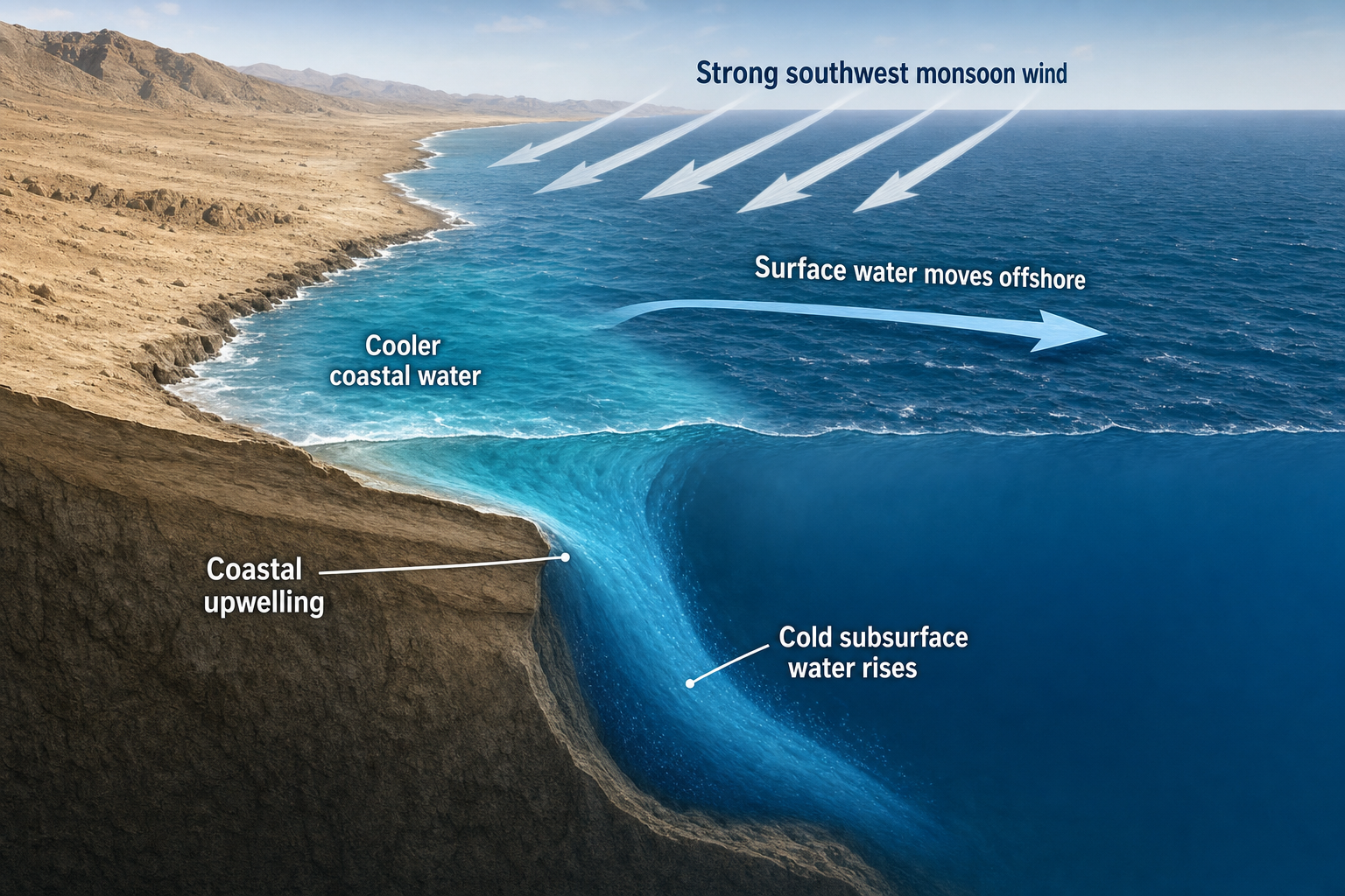
During the peak southwest monsoon, strong winds cause upwelling along the coasts of Somalia and Oman. Cold subsurface water rises to the surface and can drop coastal water temperatures dramatically. This upwelling reduces cyclone potential in the western Arabian Sea during peak monsoon months, though the same wind field continues generating large surf regardless. A wireless weather station can help you track local temperature, humidity, and pressure trends at home, which is especially useful for monitoring approaching weather systems.
Local Winds and Wave Quality
Swell size is only part of the forecast. Local wind usually decides whether the waves are clean or chaotic. During the southwest monsoon, exposed coasts frequently deal with persistent onshore or sideshore wind. That means plenty of swell but not always quality surf. Early morning lulls, wind shadows, and protected points become strategically important in those conditions.
During the northeast monsoon and post-monsoon windows, winds are generally lighter. On India’s west coast, morning land breezes can groom small SW or SSW swell into clean, organized surf. Afternoon sea breezes can add texture later in the day, especially near broad sandy beaches. Keeping tabs on local wind is easier with a handheld wind meter at the beach, while monitoring barometric pressure trends with a marine barometer can give you early warning of changing conditions.
What Arabian Sea Storms Look Like on a Weather Map
Southwest Monsoon Pattern
A southwest monsoon map does not usually show one neat circular storm. Instead, it shows a large-scale pressure pattern — low pressure over northwest India and Pakistan, with higher pressure to the south over the Indian Ocean. Wind maps show a broad stream of SW winds crossing the Arabian Sea.
The strongest wave-generating area often appears as a long band of 25 to 40-knot wind stretching from near Somalia toward the central or northern Arabian Sea. Satellite images may show widespread cloud bands and active convection, but the key feature for surf forecasting is the long, persistent fetch. Learning to read these pressure charts is a skill that improves with practice. A guide to reading nautical charts can help you build that foundation, particularly if you also spend time on the water.
Tropical Cyclone Pattern
A tropical cyclone appears on a weather map as a compact low-pressure system with closed isobars around the center. Stronger cyclones may display a dense circular cloud mass or a visible eye on satellite imagery. Wind barbs or model wind shading show gale-force winds wrapping tightly around the low.
For surf forecasting, the most productive part of the cyclone is not always the center. The strongest swell often radiates from the quadrant where winds are most intense and aimed toward the coast. A cyclone moving toward a coastline’s swell window can create a moving fetch effect, which increases both swell size and period as the storm approaches.
Shamal Pattern
A shamal map typically shows high pressure over the Arabian Peninsula, Iraq, or Iran, with lower pressure farther east or southeast. The isobars orient in a way that drives NW wind down the Persian Gulf and potentially into the Gulf of Oman.
For surf forecasting, the key question is whether that NW wind extends far enough beyond the Gulf into open water. If the fetch is confined too far north, the swell may not reach exposed Arabian Sea breaks with enough energy to be useful. Monitoring these patterns with a handheld VHF marine radio that receives weather broadcasts can be helpful when you are on the water and away from internet access.
Northeast Monsoon Pattern
A northeast monsoon map often shows high pressure settled over the Asian continent with flow moving from land toward the Arabian Sea. The wind is typically drier and cooler than the summer monsoon air. The pattern can improve surface conditions on west-facing Indian beaches, but it does not generate much swell there on its own. To forecast good winter waves, look for a combination of light offshore wind alongside a separate S or SW swell source tracking into the region.
How to Forecast Arabian Sea Waves from Storms
Step 1: Identify the Swell Source
Start by deciding what is generating the waves. Is it the southwest monsoon, a tropical cyclone, a shamal, a northeast surge, or a distant southern Indian Ocean low? Each source has a different signature and a different expected wave period. As a rough guide, local sea breezes produce 3 to 6-second chop. Shamal events and northeast monsoon winds often produce 5 to 9-second waves. Southwest monsoon fetches commonly produce 8 to 12-second swell. Tropical cyclones and distant southern lows can push 12 to 18-second swell toward the coast.
Step 2: Check Wind Speed and Fetch Alignment
Look at wind maps from reliable models and focus on the area of strongest wind over open water. As a rough threshold, 15 to 20 knots over a reasonable fetch can produce small surf. Winds of 25 to 35 knots over hundreds of kilometers generate solid swell. Cyclone-force winds can create much larger waves when they are aimed correctly at the coast.
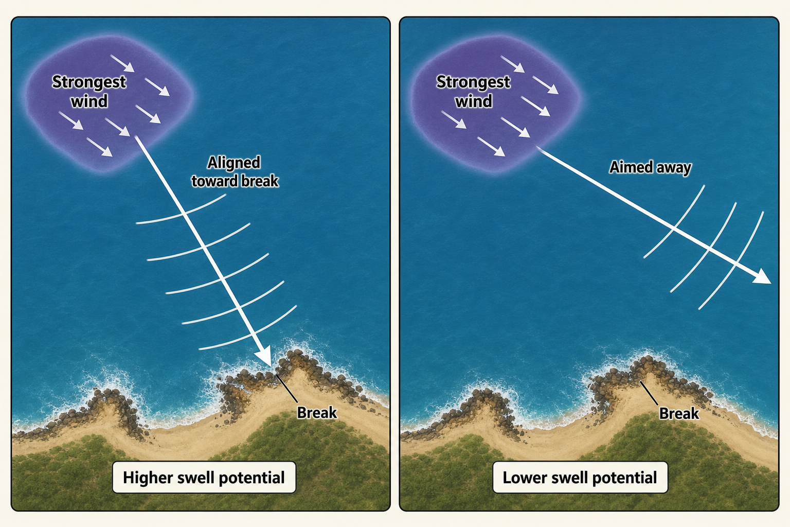
Alignment matters. Draw a line from the area of strongest wind toward your coastline. If the wind is blowing along that line toward the break, swell potential is much higher. If the wind is aimed away from the coast, the storm may look impressive on a chart but deliver very little surf. A waterproof regional map is handy for visualizing fetch angles, especially when planning trips around seasonal swell windows. Protecting your charts and printed maps at sea is straightforward with a waterproof map case.
Step 3: Estimate Swell Arrival Time
Longer-period swell travels faster than shorter-period swell. In deep water, swell group speed in knots is approximately 1.5 times the wave period in seconds. A 12-second swell travels at roughly 18 knots, while a 16-second swell moves at about 24 knots.
A simple formula for estimating arrival time is:
Travel time in hours = distance in nautical miles ÷ (1.5 × swell period in seconds)
If a cyclone generates 14-second swell 1,000 nautical miles from a break, the first energy may arrive in roughly 48 hours. The strongest surf usually arrives later, once the bulk of the swell fills in.
Step 4: Watch Swell Period and Direction
Period changes the way waves behave when they reach the coast. Short-period waves are more affected by local wind and tend to break in a weaker, peakier fashion. Long-period waves feel the seabed earlier, refract more strongly around headlands and reefs, and can concentrate energy onto specific points or breaks.
Direction is equally critical. A west-facing beach in India may respond strongly to SW or WSW swell, while a south-facing Omani coast may prefer S or SSW. A small directional shift can be the difference between overhead surf and a near-flat lineup. Jotting down your observations with a weatherproof field notebook means you will have reliable records even if conditions turn rough.
Step 5: Compare Model Data with Real Observations
Wave models are useful tools, but they are not perfect. Cross-reference model output with satellite wind observations, available buoy readings, and coastal reports from people in the water. Scatterometer wind data can confirm whether a storm is producing the winds shown by the model.
In the Arabian Sea, model errors are more common during tropical cyclones, coastal wind jets, and rapidly changing monsoon bursts. If observed winds are stronger or broader than forecast, expect more swell than the model suggests. If the fetch collapses earlier than predicted, scale the forecast down accordingly. Staying connected to live weather alerts while out at sea is much easier with a portable weather alert radio.
Step 6: Forecast Local Wave Quality
After estimating size, period, and direction, look at the local wind forecast. Light offshore wind can turn modest swell into excellent surf. Strong onshore wind can ruin even a powerful groundswell. Check tide and bathymetry as well. Long-period cyclone swell may be too straight-on for some beachbreaks but excellent on reefs or points. Short-period shamal swell may be weak on deep-water reefs but still fun on exposed beachbreaks with the right bottom contour.
Practical Forecasting Examples
Monsoon Swell for India’s West Coast
A broad 30-knot SW wind field stretches from the western Arabian Sea toward the Indian coast for several days. The expected swell is SW to WSW, with 8 to 11-second periods. Exposed beaches may be 5 to 8 feet, but local wind is likely onshore during peak monsoon. The best surf will be at protected points, semi-sheltered bays, or during brief morning lulls before the wind fills in.
Cyclone Swell for Oman
A tropical cyclone forms in the central Arabian Sea and tracks northwest, with its southern and eastern quadrants directing strong winds toward Oman. Focus on S to SE swell with periods likely in the 12 to 16-second range if the storm is intense. If local winds near the coast remain light, exposed points and reefs can see high-quality surf. If the cyclone tracks too close to shore, local wind and rough weather may reduce conditions significantly.
Winter Shamal Swell for the Gulf of Oman
High pressure builds over Arabia while lower pressure sits to the east. NW winds reach 25 to 35 knots through the Gulf of Oman and into the northern Arabian Sea. Expect short to mid-period NW or NNW swell, typically 6 to 9 seconds. Conditions are often poor during the strongest wind, then improve as the fetch relaxes and leftover swell continues to run through.
Arabian Sea waves are shaped by a mix of seasonal monsoon systems, compact tropical cyclones, winter pressure surges, and occasional distant groundswell. The southwest monsoon provides the most consistent energy, cyclones deliver the most powerful long-period surf, and the winter transition periods often bring cleaner but smaller conditions. Good forecasting starts with reading the storm pattern, then working through fetch, direction, travel time, and local wind. Once those pieces come together, the Arabian Sea becomes a much more readable swell environment, and its best surf windows become far more predictable.