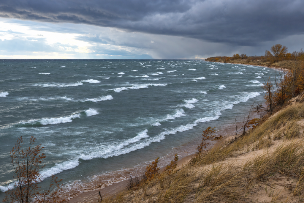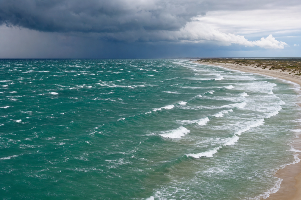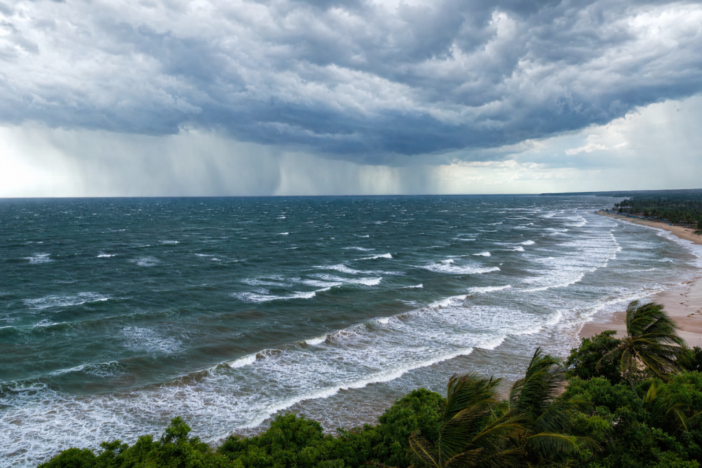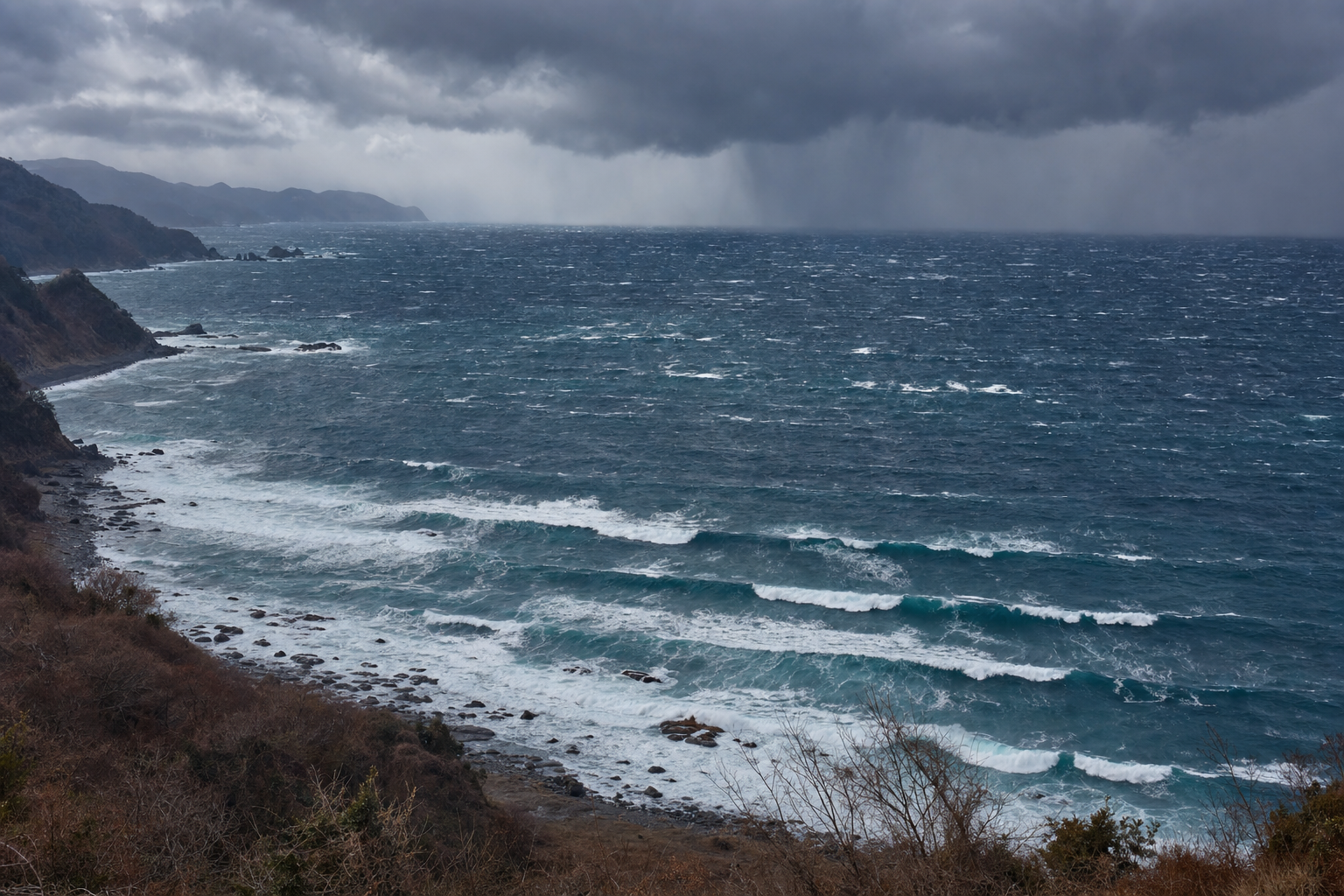
The Sea of Japan can look completely calm one day and transform into a powerful surf zone the next. Unlike the Pacific side of Japan, where long-period groundswell travels thousands of kilometers before reaching shore, most Sea of Japan waves are generated inside the basin itself. That makes surf forecasting here a study in regional weather — pressure gradients, cold-air outbreaks, fast-moving lows, and typhoons — with short but rewarding windows of clean surf after storms pass. If you want to go deeper on the science behind wave formation, a solid oceanography textbook is a great starting point for understanding how wind, water, and energy interact. For those who want a surfer-specific take on reading the ocean, this surf forecasting guide breaks down swell, fetch, and storm patterns in accessible, practical terms.
How Sea of Japan Waves Are Generated
The Sea of Japan is a semi-enclosed sea bordered by Japan, Korea, and Russia. Because it has limited connection to the open Pacific, it rarely receives true oceanic groundswell. Almost all surfable waves are generated by wind blowing across the sea for enough time and distance to build wave energy. Understanding the basics of that process is key to reading forecasts accurately.
Wind Speed, Fetch, and Duration
Three ingredients matter most for wave generation:
- Wind speed: Stronger wind transfers more energy into the water surface.
- Fetch: The longer the uninterrupted stretch of water under that wind, the larger and more organized the waves can become.
- Duration: Wind needs to blow from a consistent direction long enough for the sea state to fully develop.
In the Sea of Japan, winds of 15 to 20 knots can produce small but surfable wind swell if they last long enough. Winds of 25 to 35 knots over a good fetch can produce solid surf at exposed beaches. Gale-force winds sustained over a long winter fetch can create offshore significant wave heights of 3 to 5 meters, with even larger seas during severe storms.
Because the basin is limited in size, wave periods are typically shorter than open-ocean swell. Surfable periods usually fall between 6 and 10 seconds. Stronger or longer-lived lows — and typhoon-influenced systems — can push periods into the 10 to 13 second range.
Why Sea of Japan Swell Rises and Fades Quickly
The same geography that limits swell period also makes the Sea of Japan highly responsive to weather changes. Waves often build during the storm itself, then fade within 12 to 36 hours after the wind relaxes. Cleanup windows can be brief, especially after winter cold fronts, when favorable wind may only last a morning before the next system moves in.
Swell travel time is also short compared to open-ocean groundswell. Deep-water wave group speed is roughly 2.8 times the wave period in kilometers per hour. A 10-second swell travels about 28 kilometers per hour, meaning energy generated 600 kilometers away may take around 20 hours to arrive. When the fetch is close to the coast, surf can start building almost immediately with the wind.
Sea of Japan Swell Direction Depends on the Coast
Swell direction is measured from where the waves originate. A northwest swell travels from the northwest toward the southeast. This matters enormously in the Sea of Japan, where peninsulas, islands, bays, and headlands block or focus energy depending on the direction.
Japan’s West Coast Swell Windows
For most surf areas along Japan’s west coast, the main wave-producing directions are:
- West to northwest: The classic winter monsoon direction, especially for the San’in, Hokuriku, Niigata, and Akita regions.
- Northwest to north: Common after strong cold fronts and lows developing near Hokkaido or the northwestern Pacific.
- Southwest to west: Possible ahead of Sea of Japan lows or typhoons tracking north through the basin.
Many Japanese west-coast beaches are exposed to the same winds that generate the waves, so surf is often messy during the height of the storm. The best quality typically comes when the swell lingers but local wind turns light, offshore, or cross-offshore.
Korea’s East Coast Swell Windows
Korea’s east-facing beaches need a different wind setup. A pure northwest winter monsoon often blows offshore from the Korean Peninsula, flattening the nearshore waters even while sending swell toward Japan. Korea’s better Sea of Japan surf usually comes from:
- East to northeast winds over the western Sea of Japan.
- Lows positioned south or east of Korea that create onshore fetch.
- Typhoons or transitioning lows that send east, southeast, or northeast swell into the coast.
The Main Storm Types That Generate Sea of Japan Waves
Winter Monsoon Storms: The Most Frequent Wave Maker
The dominant winter setup is the classic west-high, east-low pressure pattern. A strong Siberian High builds over the Asian continent, while low pressure deepens near northern Japan or the northwestern Pacific. The pressure gradient between them drives cold northwest winds across the Sea of Japan.
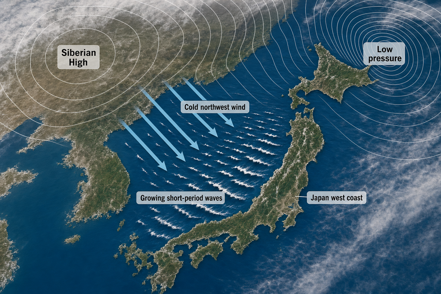
This pattern is the most reliable wave machine for Japan’s west coast. Cold, dry continental air moves over the comparatively warmer sea — particularly where the Tsushima Warm Current keeps surface temperatures relatively mild. The air warms from below, atmospheric instability increases, and stronger winds from aloft mix down to the surface. The result is gusty wind, snow showers, and rough wind swell. Keeping a marine barometer handy lets you monitor pressure trends as these systems develop and move through.
Typical winter monsoon surf:
- Swell direction: West, west-northwest, or northwest — occasionally north-northwest.
- Offshore wave height: Often 2 to 5 meters at exposed locations.
- Period: Usually 7 to 10 seconds, occasionally reaching 11 seconds or more.
- Quality: Stormy during the blow, improving as winds ease or go offshore.
Sea of Japan Lows: Larger and More Variable Swell
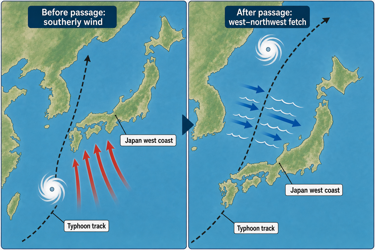
Extratropical lows frequently form or intensify over the East China Sea, Yellow Sea, or the Sea of Japan itself. These systems can generate strong southerly or southwesterly winds ahead of their center, followed by west or northwest winds after the cold front sweeps through.
Storm track is everything when forecasting these events. A low moving northeast through the Sea of Japan can produce one swell direction before the front and a completely different one after it passes. Beaches that stay flat in southwest swell may suddenly come alive once a northwest fetch fills in behind the system. Monitoring a portable weather station can help you track these pressure and wind shifts in real time.
Typical Sea of Japan low surf:
- Swell direction: South-southwest ahead of the low; west to northwest behind it.
- Offshore wave height: Commonly 1.5 to 4 meters, larger with deeper lows.
- Period: 7 to 11 seconds.
- Quality: Changeable, with good windows between wind shifts.
Polar Lows and the Japan Sea Polar-Airmass Convergence Zone
During strong winter cold-air outbreaks, small but intense lows can spin up over the Sea of Japan. These polar lows may not look dramatic on broad weather charts, but they can create localized gales, sudden direction changes, and unexpectedly large short-period surf.
A related feature worth understanding is the Japan Sea Polar-airmass Convergence Zone. It forms when cold monsoon flow splits around mountains on the Asian continent and converges over the open sea. On satellite images, it often appears as a long band of cloud and snow showers extending toward the Japanese coast. For surfers, this convergence zone can focus wind and wave energy into specific regions — particularly along the Hokuriku and Niigata coasts. Forecast models sometimes underestimate these events because the strongest winds are narrow and localized. Having a handheld anemometer at the beach lets you verify actual wind speed when model guidance seems off.
Typhoons and Transitioning Tropical Systems
Typhoons are less frequent wave producers in the Sea of Japan than winter storms, but they can generate some of the largest and most powerful surf when the track is right. The best Sea of Japan typhoon swells typically occur when a tropical cyclone moves north through the East China Sea, crosses Kyushu or Korea, and enters the basin.
As a typhoon recurves northward, it often expands in size and begins transitioning into an extratropical low. That larger wind field can create a broader fetch than the compact tropical core alone. Southerly or southwesterly swell may arrive ahead of the storm, followed quickly by west or northwest swell after passage.
Typical typhoon-influenced Sea of Japan surf:
- Swell direction: South, southwest, west, or northwest depending on track.
- Offshore wave height: Often 2 to 5 meters at exposed coasts, sometimes higher.
- Period: Commonly 8 to 13 seconds.
- Quality: Highly track-dependent; often best just before or after the strongest local wind.
Summer Fronts and Local Winds
Summer is usually the quietest season. The Pacific High frequently dominates, pressure gradients weaken, and the Sea of Japan can go flat for extended stretches. Small wind swell may form from sea breezes, weak frontal boundaries, or easterly pressure gradients near Korea. These waves are typically short-period and inconsistent, though surfable at exposed sandbars. Typhoons are the main exception, especially from late summer into autumn. It’s still worth keeping a weather alert radio charged during these months, as conditions can change quickly when tropical systems approach.
Typical Sea of Japan Waves by Season
| Season | Main Weather Pattern | Typical Swell Direction | Offshore Wave Height and Period | Typical Wave Quality |
|---|---|---|---|---|
| Winter December to February |
Siberian High, deep lows near Japan, strong northwest monsoon | West to northwest for Japan’s west coast; east to northeast only during special setups for Korea | 2 to 5 meters common at exposed locations; 7 to 10 seconds | Very consistent but often windy. Best during lulls, post-front cleanup, or at protected points. |
| Spring March to May |
Migrating lows, fronts, weaker cold outbreaks | Southwest ahead of lows; west to northwest after fronts | 0.8 to 3 meters; 6 to 10 seconds | Less consistent than winter but often cleaner, with more manageable wind. |
| Summer June to August |
Weak pressure gradients, rainy-season fronts, occasional typhoons | Variable; local wind swell or typhoon south and southwest swell | 0.3 to 1 meter in typical wind swell; 1.5 to 5 meters in typhoon surf; 4 to 13 seconds | Often small. Typhoon windows can be powerful but short-lived. |
| Autumn September to November |
Typhoons, transitioning lows, first winter-style outbreaks | Southwest to west during typhoons; west to northwest after cold fronts | 1 to 4 meters common; 7 to 12 seconds | One of the best quality seasons, mixing size with cleaner wind windows. |
What Sea of Japan Wave-Producing Storms Look Like on a Weather Map
Learning to read a surface pressure chart is one of the most valuable skills a Sea of Japan surfer can develop. Understanding weather terminology makes that process much easier — a weather dictionary is a handy reference to keep nearby. For those who also work with paper or electronic charts, a nautical chart guide provides useful context for reading geographic and oceanographic information alongside weather data.
Winter Monsoon Weather Maps
On a surface pressure chart, the winter monsoon pattern is straightforward to recognize. Look for a strong high over Siberia or Mongolia — often exceeding 1030 hPa — and low pressure near northern Japan or the northwestern Pacific. The isobars between them will be tightly packed over the Sea of Japan.
When those isobars are close together and aligned so wind blows from northwest to southeast across the basin, Japan’s west coast is likely to see building surf. If the low deepens east of Hokkaido and the continental high strengthens, the fetch can sustain for more than a day.
Sea of Japan Low Weather Maps
A Sea of Japan low appears as a closed low-pressure center moving northeast through the basin or across nearby land areas. It typically has a warm front extending east or northeast and a cold front trailing south or southwest.
Ahead of the low, winds are usually south or southwest. Behind the cold front, they swing west or northwest. The best surf window may not coincide with the lowest pressure reading, but rather with the moment the wind direction aligns with your beach and begins to ease before the swell fades.
Polar Low and Convergence Zone Maps
Polar lows can be subtle on standard pressure maps, sometimes showing as a small closed circulation or just a kink in the isobars over the Sea of Japan. Satellite imagery is often more revealing — look for comma-shaped cloud spirals or narrow bands of convective snow clouds.
The Japan Sea Polar-airmass Convergence Zone may appear as a persistent cloud band stretching from the Korean side of the sea toward Japan. Even when the official surface chart looks unremarkable, that band can signal localized strong wind and enhanced wave generation at specific points along the coast.
Typhoon Weather Maps
A typhoon or transitioning tropical system appears on the chart as a tightly wound low tracking north from the East China Sea, Korea Strait, or western Japan. As it moves into cooler latitudes, the storm typically expands and frontal structure begins to develop.
For surf forecasting, the ideal storm track depends on the coast. A system passing west or northwest of a Japanese west-coast break may first deliver strong southerly winds, then generate a westerly or northwesterly fetch after passage. A storm passing east of Korea can produce more favorable east or northeast swell for Korean beaches. A detailed world atlas is useful for visualizing how typhoon tracks relate to coastline orientation and fetch geometry. Keeping a waterproof map case in your vehicle or bag means your printed charts stay protected when you’re checking conditions at the beach.
How Weather, Temperature, and Pressure Shape Sea of Japan Surf
Atmospheric Pressure Creates the Wind Engine
Low pressure alone does not make waves. The key is the pressure gradient — the rate of pressure change over distance. Closely spaced isobars indicate stronger wind. A moderate low can produce excellent surf if the gradient is tight and the fetch is well aimed at the coast.
As a rough forecasting guide:
- 20 knots over several hundred kilometers: Small to moderate short-period surf.
- 30 knots for 12 to 24 hours: Solid surf at exposed beaches.
- 40 knots or more over a long fetch: Large, stormy seas with potential cleanup surf afterward.
Cold Air Over Warm Water Intensifies Winter Surf
Winter surf in the Sea of Japan is strongly influenced by temperature contrast. When very cold continental air from Siberia crosses the comparatively warmer sea, the lower atmosphere becomes unstable. This instability generates convective clouds, snow showers, and gusty surface winds — particularly where the Tsushima Warm Current keeps water temperatures elevated.
The effect is most intense when the cold air mass aloft is unusually deep. In these events, surface wind can be stronger than standard models predict, especially beneath snow squalls and convergence bands. That instability adds wave size but also creates rougher, choppier surf until conditions ease. A VHF marine radio is a practical tool for receiving real-time marine weather broadcasts when you’re near the water during these conditions.
Stable Air Can Reduce Expected Wave Size
In spring and early summer, warm air moving over relatively cooler water can create a stable marine boundary layer. This stability prevents stronger winds aloft from mixing down to the sea surface. A weather chart may show a decent pressure gradient, but actual wind over the water can be weaker than expected.
This is one reason real-time observations matter so much in the Sea of Japan. Coastal wind stations, offshore buoys, and satellite wind data can reveal whether forecast winds are actually reaching the surface — or whether a stable layer is holding them back.
How to Forecast Sea of Japan Waves from Regional Storms
Start with Your Break’s Swell Window
Before assessing storm strength, identify what swell directions your break can actually receive. A west-facing beach, a northwest-facing reef, and a protected bay may respond completely differently to the same storm system.
Check for swell blockers such as:
- Peninsulas and capes that shadow certain directions.
- Offshore islands such as Sado or Oki that absorb or deflect incoming energy.
- Deep bays that require longer wave periods for swell to wrap inside effectively.
Short-period Sea of Japan swell does not refract as efficiently as long-period Pacific groundswell. If a break is partly shadowed, it may need a stronger or more directly aligned swell to light up. A coastal navigation chart can help you identify these geographic swell shadows around your local breaks.
Match the Wind Fetch to the Coastline
On a weather map or wind model, ask one straightforward question: is the wind blowing across open water toward your surf spot? For Japan’s west coast, northwest and west winds are the primary generators. For Korea’s east coast, east and northeast fetches matter most.
The strongest storm is not always the best surf producer. A deep low with winds blowing parallel to the coast may generate less surf than a weaker system with a long, direct fetch aimed at your beach.
Estimate Wave Size and Period
Use wind speed, fetch length, and duration together to estimate size category. In this limited basin, periods are usually modest:
- Local wind swell: 4 to 7 seconds.
- Developed regional swell: 7 to 10 seconds.
- Strong low or typhoon swell: 10 to 13 seconds.
If the model shows 2 meters at 8 seconds from a direct swell direction, exposed beaches will generally have surfable waves. If it shows 1 meter at 5 seconds, only the most exposed breaks with favorable sandbars may be worth the trip.
Time the Buildup and Cleanup
Sea of Japan surf often peaks while the wind is still onshore. The better-quality window typically arrives when the storm moves away, the pressure gradient relaxes, or local winds turn offshore. For many Japanese west-coast breaks, favorable winds often come from landward directions such as east or southeast. If a northwest swell is still running while morning land wind turns light and offshore, conditions can improve quickly — though the swell may also be fading fast. This is exactly where keeping a surf log comes in handy, helping you build a personal record of how specific storms perform at your local breaks over time.
Use Observations to Adjust the Forecast
Wave models are a useful starting point, but the Sea of Japan rewards real-time checking. Compare any forecast with:
- Coastal wind stations and offshore buoys for actual wind and sea state data.
- Satellite scatterometer wind passes when available.
- Radar and satellite imagery during winter snow-band events.
If observed winds are stronger than modeled across the fetch, expect more size. If winds are weaker or angled differently, downgrade the forecast accordingly. During polar lows and convergence-zone events, localized surf can exceed model guidance in one region while nearby coasts underperform. Jotting down observations on-site is easier with a weatherproof notebook that holds up to spray and rain.
Sea of Japan Wave Quality: Why the Best Surf Often Comes After the Storm
Wave quality in the Sea of Japan depends as much on local wind conditions as on raw swell height. Because most storms generate waves close to the coast, the sea surface tends to be choppy during the building phase. Short-period swell also creates less organized, peakier conditions than long-period ocean groundswell.
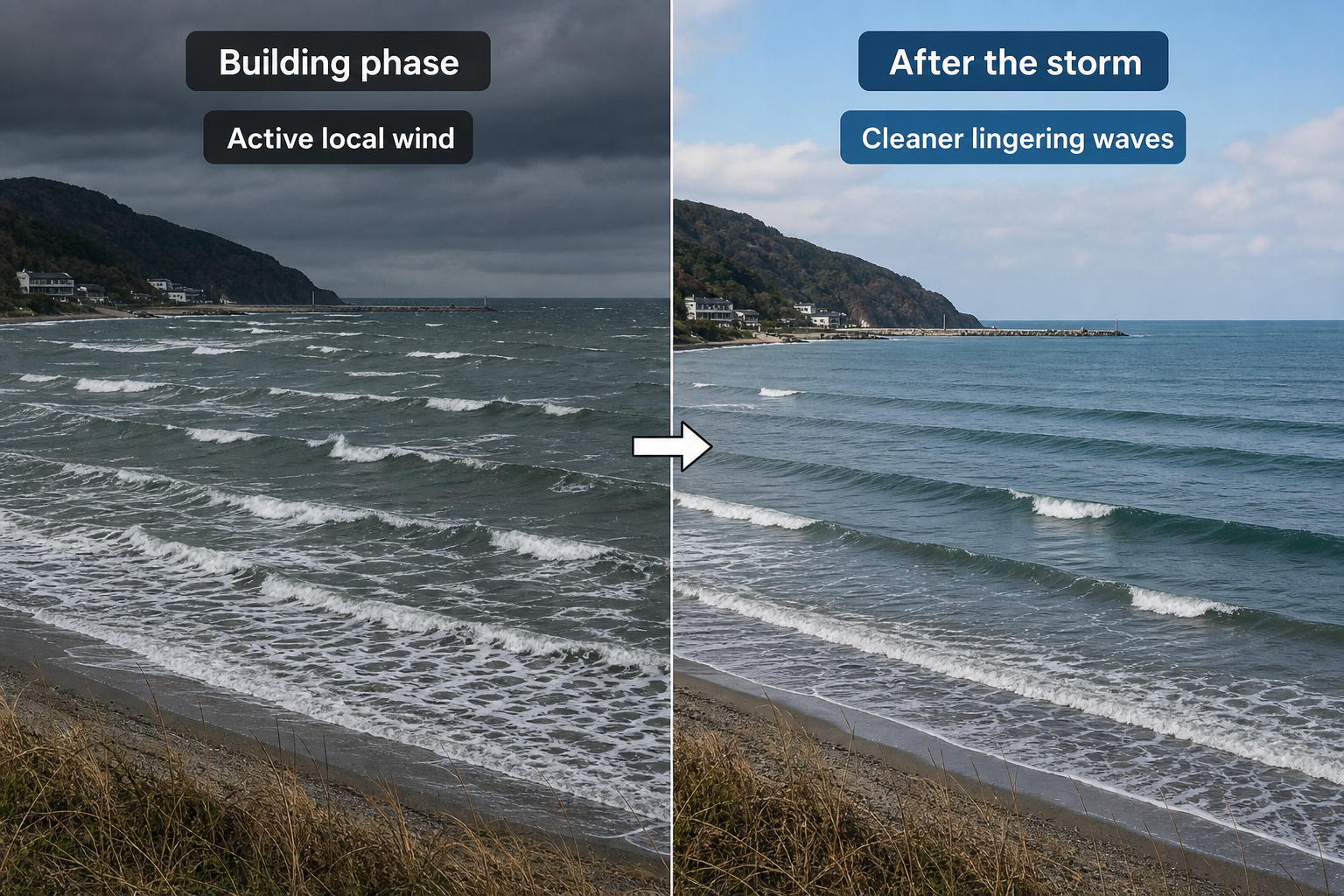
The best setups usually follow three recognizable phases:
- Wave generation: Strong wind blows across the basin toward the coast, building swell height and energy.
- Wind shift: The storm moves on, the front passes, or high pressure begins to ridge in behind the system.
- Cleanup: Swell remains while local wind becomes light or turns offshore, improving surface conditions.
Autumn and spring often provide the cleanest version of this pattern because storms aren’t followed immediately by relentless monsoon wind. Winter offers more consistent size but demands careful timing and solid knowledge of protected spots that allow you to surf during the blow.
Practical Sea of Japan Forecast Examples
Classic Winter Northwest Swell
A 1040 hPa Siberian High builds over the continent while a 980 hPa low deepens east of Hokkaido. Tight isobars cover the Sea of Japan for 24 hours, with northwest winds of 30 to 40 knots across the basin.
Expect west-northwest to northwest swell, offshore seas of 2 to 5 meters, and periods around 8 to 10 seconds. Surf will likely be choppy and messy at exposed beaches during the blow, then improve noticeably if the wind eases or shifts offshore. Protected points and headland breaks are usually the better option at the peak of the storm.
Autumn Low Moving Through the Basin
A 995 hPa low tracks northeast through the Sea of Japan. Southwesterly winds build ahead of the cold front, then shift west and northwest behind it as the system moves on.
Southwest-facing exposures may see an early pulse of swell, but most west-coast Japan breaks improve on the backside fetch. The best window often comes shortly after frontal passage, when the swell is still building or holding but the local wind hasn’t yet become too strong from the northwest.
Typhoon Crossing Into the Sea of Japan
A typhoon tracks north past Kyushu, enters the Sea of Japan, and accelerates toward northern Japan while transitioning into an extratropical low. The wind field expands significantly, and strong southerly winds rotate through west after the system passes.
Expect fast-changing swell direction. Southern and western exposures may build first, followed by west or northwest swell behind the storm. Periods can reach 10 to 13 seconds, but local wind quality depends heavily on the exact track and timing of the transition.
Forecasting Sea of Japan waves is less about waiting for distant groundswell and more about reading regional weather patterns with precision. The most consistent surfers and forecasters in this region watch pressure gradients, wind direction, air-mass changes, and post-storm cleanup timing closely. Once you understand how winter monsoon flow, moving lows, convergence zones, and typhoons interact with this enclosed basin, the Sea of Japan becomes far more predictable — and its short-lived but powerful surf windows become much easier to catch.