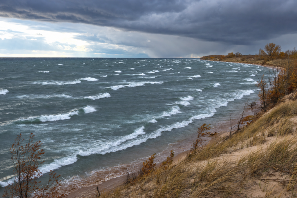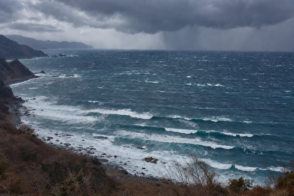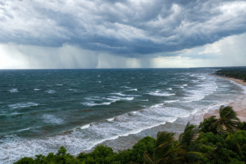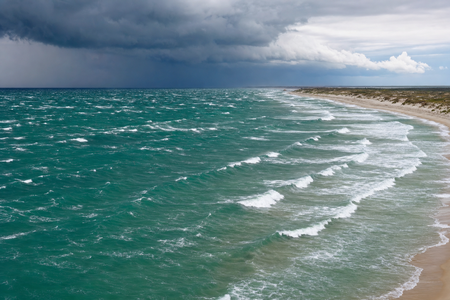
The Gulf of Mexico is a compact, semi-enclosed sea, which makes its surf both fascinating and tricky to forecast. Unlike open-ocean coastlines that receive long-traveled groundswell from distant storm belts, Gulf waves are typically generated nearby by cold fronts, tropical systems, coastal lows, or steady pressure-gradient winds. That means surf can appear quickly, peak for just a few hours, and disappear just as fast. If you want to surf the Gulf consistently, it helps to understand the ingredients that matter most: wind strength, fetch, duration, swell direction, and local cleanup winds. A good surf forecasting book can help you build that foundation before you ever look at a weather map.
Why Gulf of Mexico Waves Are Different
Most surfable waves in the Gulf are wind-generated seas rather than long-distance groundswell. The basin is large enough to produce powerful surf, especially during hurricanes, but it is still limited compared to the Atlantic or Pacific. A storm can only blow across a finite stretch of water before its waves reach land. Three factors control wave generation in the Gulf:
- Wind speed: Stronger wind transfers more energy into the sea surface.
- Fetch: A longer uninterrupted water distance allows waves to grow larger.
- Duration: Wind must blow long enough from a steady direction for organized swell to develop.
The Gulf’s shape also matters a great deal. Texas is most exposed to east, southeast, and south swell. The Florida Panhandle and Alabama receive south and southwest swell well. Florida’s west coast is most open to west, northwest, and southwest swell. A single storm can produce excellent waves for one part of the Gulf while leaving another part flat or shadowed. It’s also worth knowing that in surf forecasting, swell direction refers to where the waves are coming from. A “south swell” travels north. A “west swell” travels east. This matters when reading buoy data and surf models. If you want to dig deeper into the science behind all of this, an oceanography textbook is a worthwhile reference to keep on the shelf.
The Main Storm Types That Generate Gulf of Mexico Waves
Cold Fronts and Mid-Latitude Lows
Cold fronts are the most reliable non-tropical wave makers in the Gulf, particularly from late fall through spring. A typical setup begins with low pressure moving across Texas, the lower Mississippi Valley, or the southeastern United States. Ahead of the front, warm humid air flows northward from the Gulf. Behind it, colder and denser air pours southward under high pressure.
On a weather map, a cold front appears as a blue line with triangles pointing in the direction of movement. The low-pressure center is marked with an “L,” and the high-pressure system behind the front is marked with an “H.” Tight isobars around the low and high indicate a strong pressure gradient, which means stronger wind. If you’re still learning to read these maps, a weather terms reference guide can be a handy tool when you’re studying forecasts.
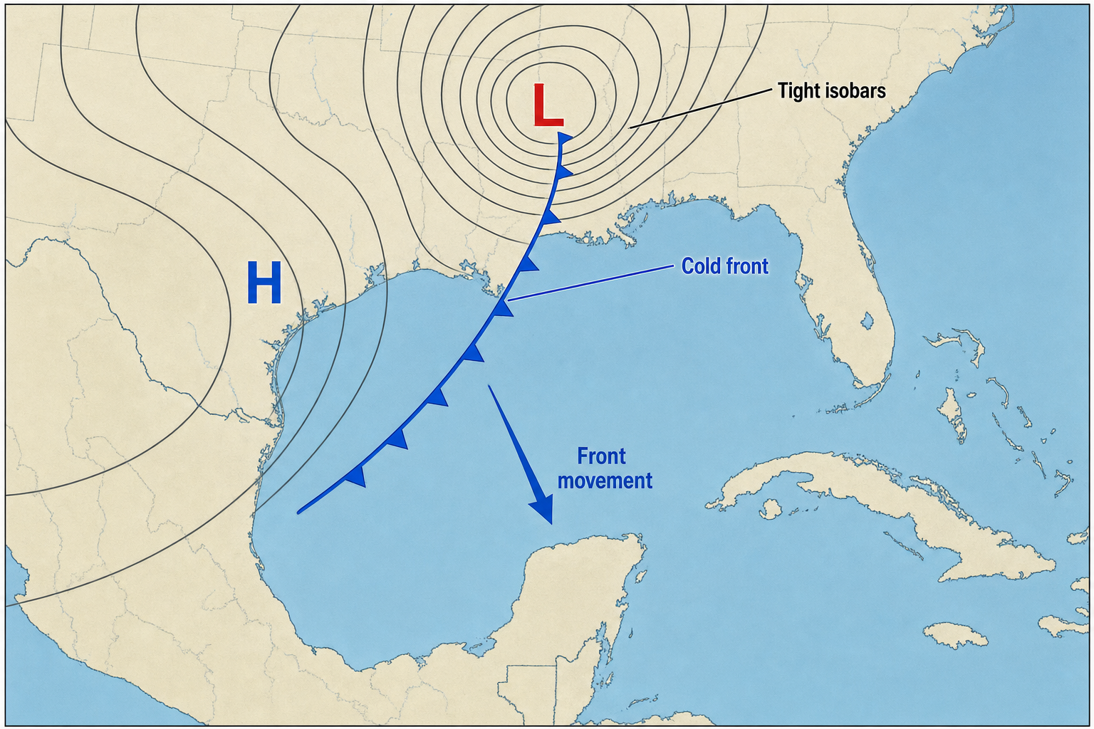
Cold fronts typically create waves in two distinct phases:
- Pre-frontal surf: South or southeast winds build short-period waves along Texas and the northern Gulf.
- Post-frontal surf: West, northwest, or north winds build waves for the Florida Panhandle and Florida’s west coast.
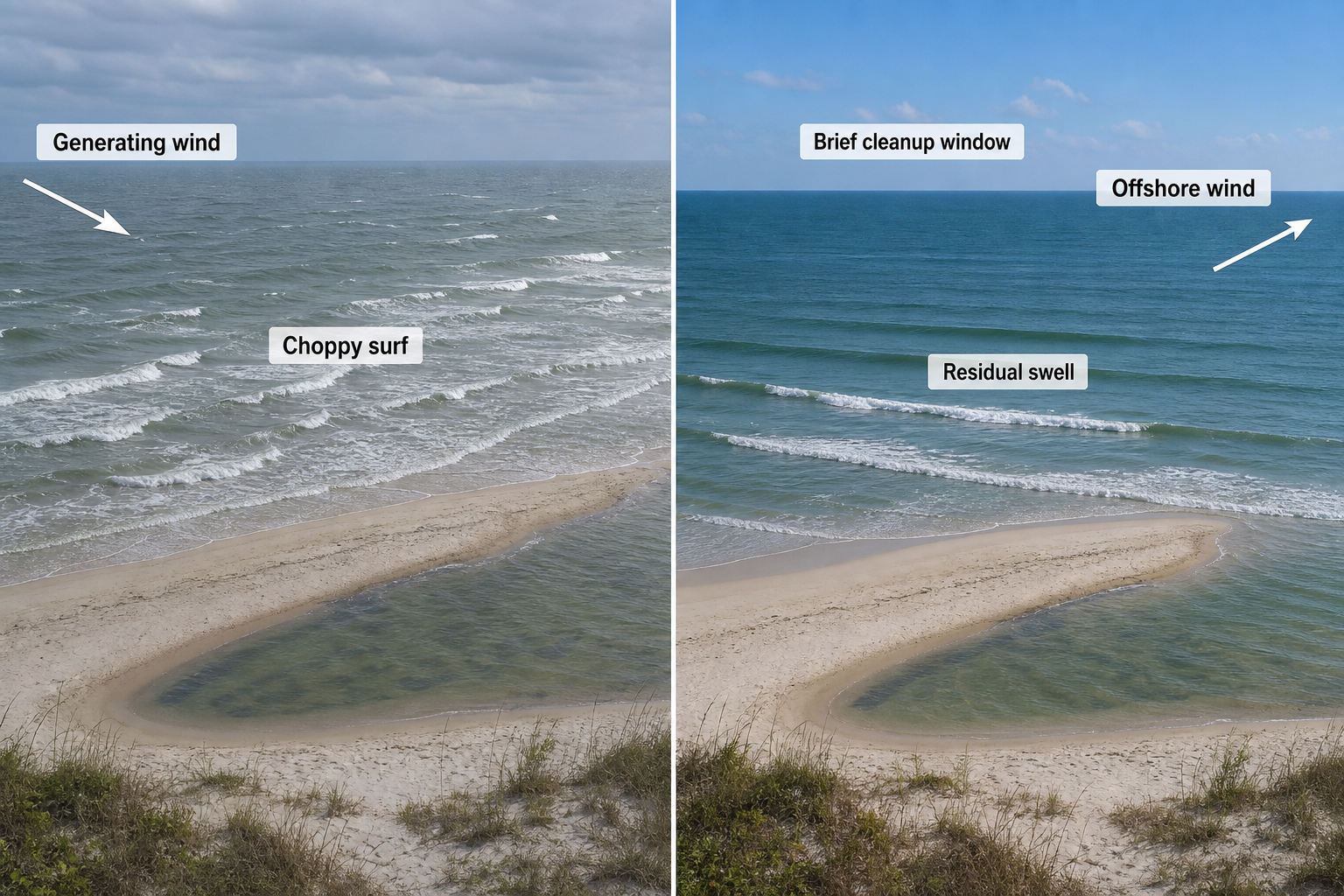
- Cleanup window: After the wind shifts offshore, leftover swell can briefly become much cleaner and more surfable.
Typical cold-front surf ranges from 2 to 6 feet at exposed beaches with periods around 5 to 9 seconds. Stronger winter lows can produce larger surf and occasional 10 to 12 second energy, but most frontal waves are steep and short-lived.
Tropical Storms and Hurricanes
Tropical cyclones are the Gulf’s premier swell producers. A tropical depression has organized low pressure and rotating winds. A tropical storm is stronger, and a hurricane has sustained winds of at least 74 miles per hour. For surfers, the best swell doesn’t always come from the most intense storm. A large, slow-moving system with a broad wind field can generate better surf than a compact, intense hurricane that races across the basin.
On a weather map, a tropical cyclone appears as a tight closed low with circular isobars and counterclockwise wind flow. Satellite images show curved rain bands, a dense central cloud mass, and sometimes a clear eye. In the Northern Hemisphere, the right-front quadrant of the storm relative to its direction of movement typically has the strongest winds, because the storm’s forward speed adds to the rotational circulation.
Tropical systems can produce swell with periods of 8 to 16 seconds in the Gulf, with rare longer-period pulses from powerful hurricanes. Surf heights vary widely. A distant tropical storm may send 3 to 6 foot lines to exposed beaches, while a well-positioned hurricane can push 8 to 12 foot surf or more. Near the storm itself, however, local wind tends to make conditions raw and disorganized.
Gulf Lows and Coastal Lows
A Gulf low forms when a frontal boundary stalls over warm Gulf water and surface low pressure develops along it. These systems can be excellent swell producers because they may sit over open water for a day or more, creating a focused fetch aimed at the coast.
On a weather map, look for a low-pressure center along a stationary front or warm front. A stationary front is drawn with alternating red semicircles and blue triangles. When isobars tighten between the low and a high-pressure system to the north, strong easterly or northeasterly winds can develop over the northern Gulf. Gulf lows often produce 3 to 8 foot surf with 7 to 11 second periods. They can be especially productive when the low is far enough offshore to generate waves while the local beach wind turns offshore or side-offshore as the system moves away.
Tropical Waves and Broad Low-Pressure Areas
Tropical waves are elongated troughs of low pressure that move westward through the tropics. Many never become named storms, but they can still increase wind, convection, and swell across the Gulf. These systems are most common from summer into fall.
On surface maps, a tropical wave may appear as a dashed trough line rather than a closed low. Satellite images show clusters of showers and thunderstorms drifting westward. If the wave interacts with warm Gulf water and low wind shear, it may organize into a tropical depression or storm. Surf from tropical waves is usually smaller and shorter-period than hurricane swell. Expect 2 to 6 feet at exposed breaks with periods near 6 to 10 seconds. If the system develops a closed circulation or stalls over open water, the surf can become more organized and consistent.
Pressure-Gradient and Return-Flow Wind Swell
Not every Gulf swell requires a storm center. Sometimes a broad high-pressure system over the Atlantic or southeastern United States combines with lower pressure over Texas, Mexico, or the Plains. The clockwise flow around the high sends persistent east, southeast, or south winds across the Gulf. This pattern is especially common in spring and creates what forecasters call “return flow,” which is warm moist air moving northward from the Gulf after a cold front has passed.
On a weather map, the setup looks less dramatic than a named storm. The key feature is a wide area of 15 to 25 knot wind blowing across open water for 12 to 36 hours. Return-flow swell is usually modest but consistent. Texas benefits most from southeast wind swell, while the northern Gulf can pick up south swell. Typical surf is 1 to 4 feet with 5 to 8 second periods. It’s often bumpy while the wind is blowing, but brief cleaner windows can occur when local winds relax.
Sea-Breeze and Thunderstorm Wind Waves
Summer afternoons can produce small local wind waves when land heats faster than water. Air rises over land, lower pressure develops near the coast, and onshore sea breezes strengthen. Thunderstorm outflows can briefly add gusty winds over nearby water. These waves are highly local and short-period, typically producing 1 to 3 feet of weak surf with 4 to 6 second periods. Quality is usually poor, but a good sandbar and light morning winds can occasionally make small waves worth paddling out for.
Seasonal Patterns for Gulf of Mexico Waves
The Gulf has a strong seasonal rhythm. Winter and spring are dominated by cold fronts. Summer is often flat unless tropical activity enters the basin. Fall offers the best combination of warm water, tropical systems, and early cold fronts.
| Season | Main Wave Makers | Common Swell Directions | Typical Height and Period | Wave Quality |
|---|---|---|---|---|
| Winter | Cold fronts, mid-latitude lows, Gulf lows | S to SE before fronts; W to NW after fronts | 2 to 6 ft; 5 to 9 sec. Strong systems can exceed this. | Short-lived but frequent. Best during offshore cleanup windows. |
| Spring | Return flow, late fronts, coastal lows | SE to S for Texas and north Gulf; W to SW for west Florida | 2 to 5 ft; 5 to 8 sec. Strong lows can reach 8 ft. | Often windy, but more consistent than summer. |
| Summer | Sea breezes, tropical waves, tropical cyclones | Highly storm-dependent; local wind swell is usually onshore | 0 to 3 ft normally; tropical surf can reach 4 to 12 ft or more. | Usually weak unless tropical energy enters the basin. |
| Fall | Hurricanes, tropical storms, early cold fronts | SE to S for western and northern Gulf; W to SW for Florida | 3 to 8 ft common during active patterns; 8 to 16 sec in tropical swell. | Often the best season for size, period, and favorable winds. |
Typical Gulf of Mexico Swell Directions by Coast
Because the Gulf coastline curves dramatically, each region responds to different storm positions. A perfect swell direction for one area may be useless for another. The table below breaks down what each section of coastline needs.
| Region | Best Swell Directions | Common Wave Sources | Forecasting Notes |
|---|---|---|---|
| Texas coast | E, SE, S; occasional NE | Return flow, western Gulf lows, tropical systems in central or eastern Gulf | Southeast wind swell is common. Offshore winds after fronts can clean up leftover surf. |
| Louisiana to Alabama | SE, S, SW | Cold-front return flow, Gulf lows, tropical cyclones | Barrier islands and shallow shelves can reduce or reshape swell. |
| Florida Panhandle | S, SW, W; some SE | Pre-frontal southerlies, post-frontal west wind, tropical storms | Westerly swell after a front can be short-lived but punchy. |
| Florida west coast | W, NW, SW | Cold fronts, Gulf lows, tropical cyclones west or south of the coast | Often best when local wind turns NE or E after the swell has already formed. |
Weather, Temperature, and Pressure Factors Behind Surfable Gulf Waves
Atmospheric Pressure Creates the Wind That Creates the Waves
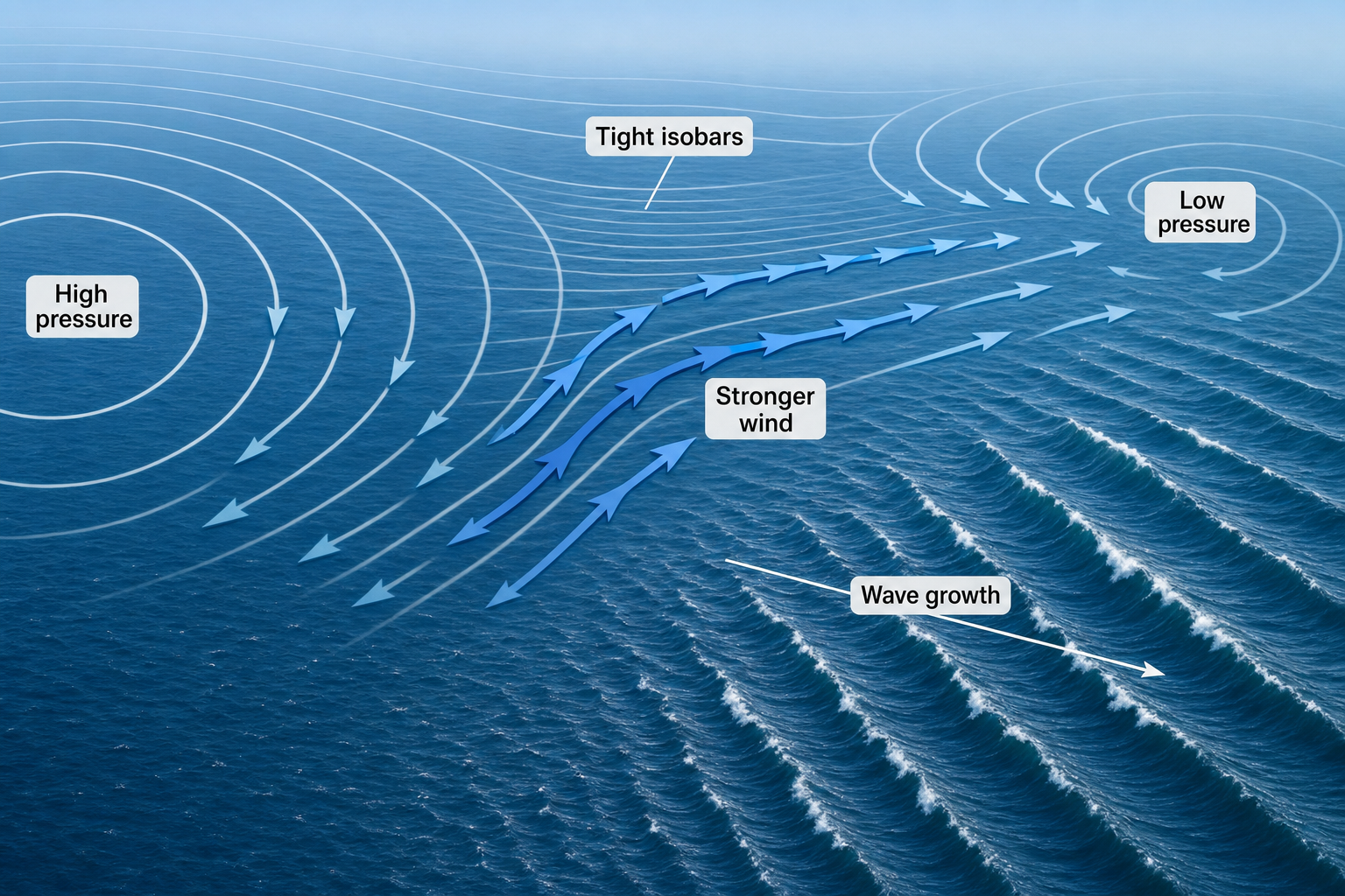
Low pressure alone doesn’t create surf. The pressure gradient does. Wind accelerates when air moves from high pressure toward low pressure, then curves due to Earth’s rotation. On weather maps, tightly packed isobars are one of the clearest signs that a strong wave-generating wind field is likely. A strong cold front might have high pressure of 1025 to 1035 millibars behind it and lower pressure near the front. A strong tropical cyclone can have central pressure below 980 millibars, but size and fetch alignment still determine surf quality at any given beach. Keeping a marine barometer at home is a simple way to track local pressure trends and get a feel for incoming systems.
Temperature Contrasts Strengthen Frontal Systems
Winter and spring cold fronts are powered by contrast. Cold dry continental air meets warm humid Gulf air, increasing instability and strengthening the frontal boundary. Ahead of the front, conditions feel warm and humid with falling pressure. Behind it, temperatures drop, skies clear, and pressure rises quickly. That wind shift is central to Gulf surf forecasting. The same front that creates messy onshore surf can later produce a clean window when the swell remains but the local wind turns offshore. A wireless weather station can help you monitor those wind and pressure shifts in real time from home.
Warm Gulf Water Fuels Tropical Surf
Tropical cyclones need warm sea-surface temperatures, deep atmospheric moisture, and relatively low wind shear. Gulf water above about 79 degrees Fahrenheit can support tropical development, especially when warm water extends well below the surface. The Loop Current and warm eddies can help storms maintain strength over the central and eastern Gulf. For surf, a storm’s track matters just as much as its intensity. A slow-moving tropical storm with 35 to 50 knot winds aimed at the coast for two days can produce better waves than a compact hurricane that orients its strongest winds away from the beach.
What Gulf Wave-Generating Storms Look Like on a Weather Map
Cold-Front Surf Setup
Look for a blue cold front pushing toward the Gulf, a low-pressure center to the north or west, and high pressure building behind it. Ahead of the front, wind arrows or barbs show south or southeast flow. Behind the front, they shift to north, northwest, or west. For Texas and the northern Gulf, the pre-frontal southerly fetch can build surf. For Florida’s west coast, the post-frontal northwest or west fetch is often more important. The best forecast clue isn’t the front line itself, but where the strongest wind is blowing over open water and whether it’s pointed toward your coast.
If you’re spending time on the water and want to stay updated on changing conditions, a handheld VHF marine radio keeps you connected to NOAA weather broadcasts no matter where you are. For home use, a dedicated NOAA weather alert radio is a reliable way to catch incoming storm warnings around the clock.
Tropical Cyclone Swell Setup
Look for a closed low with circular isobars, a strong and expansive wind field, and a track that leaves open water between the storm and your beach. The most useful swell-producing fetch is the portion of the storm where winds are blowing toward your coastline for many hours. If a hurricane is sitting in the central Gulf, it can send swell in multiple directions at once. Texas may receive east or southeast swell. The northern Gulf may pick up south swell. Florida’s west coast may see west or southwest swell if the storm is positioned far enough west or south.
Gulf Low Surf Setup
Look for a stalled front over the Gulf with a developing low forming along it. The strongest waves usually form where the low tightens the pressure gradient against high pressure to the north. A long east or northeast fetch across the northern Gulf can be productive for Texas. A west or southwest fetch can favor Florida. These setups can be among the most rewarding to forecast because the low often sits in one place long enough to build organized, longer-period swell.
Return-Flow Wind Swell Setup
Look for high pressure east of the Gulf and lower pressure to the west. The isobars don’t need to be extremely tight, but the wind must be steady and persistent. If southeast winds cover a large part of the western Gulf for a full day, Texas often sees rideable wind swell. If south winds extend across the central Gulf, the northern coast can pick up surf. This is one of the more subtle setups to recognize, but it’s worth learning because it happens regularly in spring.
How to Forecast Gulf of Mexico Waves from Regional Storms
Step 1: Identify the Swell Source
Start with a surface weather map and wind forecast. Find the storm, front, low, or pressure gradient you’re working with. Then ask one simple question: is there sustained wind blowing over open Gulf water toward the beach? Don’t focus only on the storm center. The wave-making area may be hundreds of miles away from the low. For tropical systems especially, the strongest swell can come from a broad outer wind band rather than the eye itself.
Step 2: Judge Wind Speed, Fetch, and Duration
As a general Gulf forecasting guide:
- 15 to 20 knots over moderate fetch can build small 1 to 3 foot surf.
- 20 to 30 knots sustained for a day can produce 3 to 6 foot surf at exposed beaches.
- 35 knots or more over long fetch can create solid surf with longer periods.
Duration matters because waves need time to organize. A six-hour wind burst may create choppy local chop. A 24-hour event can produce more defined swell. A slow-moving tropical system can generate surf for several days if the fetch stays aimed at the coast. You can measure local wind speed directly using a handheld anemometer, which is useful for checking beach conditions before you paddle out.
Step 3: Estimate Swell Travel Time
Gulf swells travel quickly because the basin is small. Deep-water wave group speed is approximately 1.5 times the wave period in knots. A 10 second swell travels around 15 knots. A 14 second swell travels around 21 knots. For example, if a buoy 300 nautical miles from your beach shows a new 10 second swell from the right direction, the energy may arrive in roughly 20 hours. Shorter-period wind swell travels more slowly and is usually tied directly to the local wind event driving it.
Step 4: Use Gulf Buoys to Confirm the Forecast
National Data Buoy Center stations are essential for Gulf surf forecasting. Offshore buoys show rising significant wave height, increasing dominant period, and shifting swell direction before the surf reaches the beach. Watch for these clues:
- Rising period: A jump from 5 seconds to 9 seconds often signals more organized swell arriving.
- Correct direction: A large swell from a blocked angle may not reach your break effectively.
- Wind shift: A local offshore shift can improve quality even as swell height fades.
Keep in mind that buoy height is not the same as breaking wave height. Offshore significant wave height represents the average of the highest one-third of waves measured. Local bathymetry, sandbars, and swell angle all determine what actually breaks at the beach. Understanding how to read nautical and coastal charts helps with this. A guide like How to Read a Nautical Chart is a solid reference for understanding depth contours and seafloor features near your local breaks. For visual reference of the broader Gulf geography, a concise world atlas can help you visualize storm positions relative to the basin as a whole.
Step 5: Forecast the Cleanup Window
Gulf surf often improves after the generating wind stops or shifts direction. This window can be brief because short-period waves decay quickly. For cold fronts, the best surf may come just after frontal passage when winds turn offshore but swell from the earlier fetch is still present. For Florida’s west coast, a classic setup is west or northwest swell followed by northeast or east wind. For Texas, southeast wind swell can clean up when winds turn north or northwest. The challenge is timing. If the offshore wind arrives too late, the swell may already be gone.
Step 6: Account for Local Geography and Bathymetry
The Gulf’s shallow shelves reshape incoming waves considerably. Long shallow approaches can slow and steepen swell in unexpected ways. Sandbars may create peaky surf from short-period waves, while jetties and passes can focus or refract certain swell angles. Shadowing is also important. The Florida Keys, Cuba, the Yucatan Peninsula, and barrier islands can all block swell. A forecast model may show energy offshore, but a particular beach may receive much less if the swell direction is partially blocked by nearby geography. A printed coastal navigation chart of your local area can reveal depth contours and geographical features that explain why certain breaks light up and others stay flat on the same swell. If you’re reviewing charts in the field or on the water, a waterproof map case keeps them protected from spray and rain.
What Makes Gulf of Mexico Wave Quality Good or Poor
Wave quality in the Gulf depends on more than size. The best days usually combine a strong enough swell source with a favorable local wind shift. Period matters too. A 3 foot swell at 10 seconds often has more push and shape than a 4 foot swell at 5 seconds. Short-period wind swell is the norm in the Gulf. It can be fun on a good sandbar, but it usually arrives alongside onshore wind and short, choppy lines. Longer-period tropical swell is rarer and more powerful, producing cleaner sets, better walls, and more defined peaks when the direction suits the coastline.
The highest-quality Gulf surf generally comes from one of three patterns: a tropical cyclone positioned far enough offshore to send organized swell without wrecking local conditions, a Gulf low with a long fetch and an offshore local wind, or a cold front with a well-timed cleanup after strong pre-frontal or post-frontal wind. Tracking your sessions and the conditions that produced them is one of the best ways to learn your local breaks. A dedicated surf journal lets you log swell direction, period, and storm type alongside session notes, which builds a personal forecasting record over time. If you prefer writing notes in wet or rainy conditions, a weatherproof notebook holds up at the beach or on a boat without falling apart.
Forecasting Gulf of Mexico waves is a study in timing and storm placement. Because the basin is enclosed, surfable energy is usually created close to home, which makes it fast-changing but also readable once you know what to look for. Learn the seasonal patterns, study the wind field rather than just the storm center, and confirm your forecast with buoy data. Once you understand how fronts, tropical systems, Gulf lows, and pressure-gradient winds work together, the Gulf becomes far less mysterious and a lot more predictable.