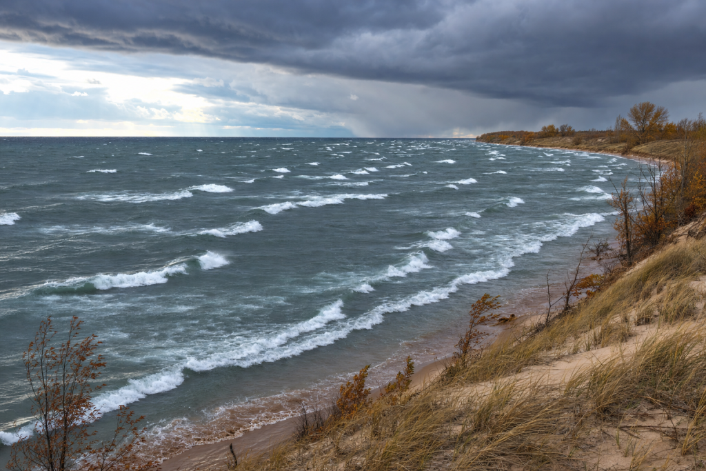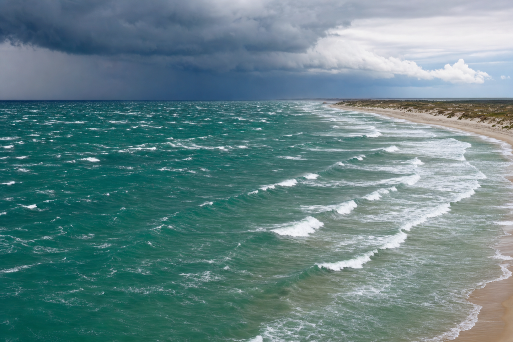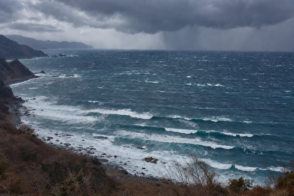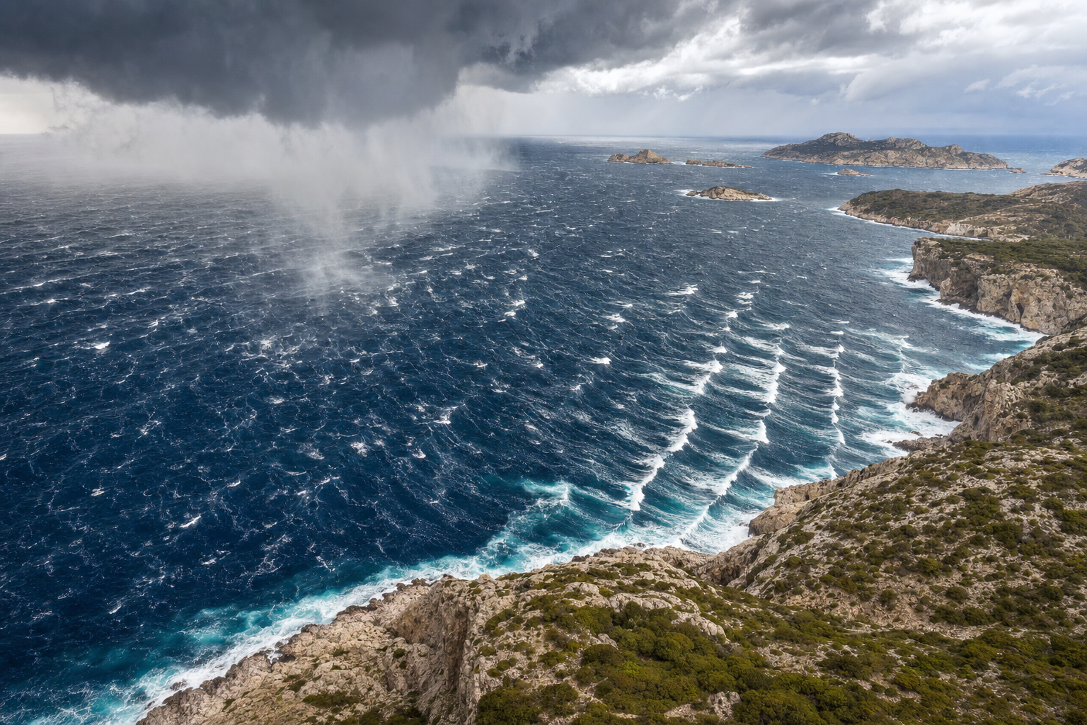
The Mediterranean Sea can look deceptively calm, but when the right storm pattern arrives, it can produce powerful, clean, surfable waves. Unlike open-ocean surf zones, the Mediterranean doesn’t receive long-traveled Atlantic or Indian Ocean groundswell. Its waves are born inside the basin from regional pressure systems, fast-moving cold fronts, and strong wind jets like the Mistral, Bora, and Sirocco. That makes Mediterranean surf forecasting highly local, highly seasonal, and deeply rewarding for surfers who know how to read a weather map. If you’re serious about understanding how ocean energy works, this surf forecasting guide is a solid starting point for building that knowledge.
Why Mediterranean Sea Waves Are Different From Ocean Swell
The Mediterranean is an enclosed sea, so wave generation is limited by wind speed, duration, and fetch. Fetch is the uninterrupted distance over water that the wind blows in the same direction. In the open Atlantic, storms can push energy across thousands of kilometers of ocean. In the Mediterranean, the fetch is usually a few hundred kilometers, though some storm tracks can line up longer corridors across the basin. Understanding the geography behind this is easier with a good reference — a detailed world atlas helps you visualize sub-basin shapes, island chains, and the mountain ranges that shape regional wind flow.
This creates waves that are often shorter-period and steeper than ocean swell. A typical Mediterranean surf event may have a period of 5 to 9 seconds. Better storms can produce 10 to 12 seconds, while anything above 13 seconds is uncommon and usually linked to a strong, well-aligned low-pressure system. The coastline also matters enormously. The Mediterranean is broken into sub-basins — the Alboran Sea, Balearic Sea, Gulf of Lion, Tyrrhenian Sea, Adriatic Sea, Ionian Sea, Aegean Sea, and Levantine Basin. Mountain ranges around these basins funnel wind into narrow corridors, which means a storm that delivers perfect surf in Sardinia may leave mainland Spain completely flat.
How Wind Generates Mediterranean Sea Waves
Wind Speed and Wave Height
Stronger wind transfers more energy into the sea surface. In the Mediterranean, a 15 to 20 knot wind may create small local wind waves. A 25 to 35 knot wind over a decent fetch can create proper surf. Winds over 40 knots can produce large storm surf, especially when they blow long enough over an open stretch of water.
As a broad rule for exposed Mediterranean coasts:
- 15 to 20 knots: small wind swell, often 0.3 to 1 meter, with 4 to 6 second periods.
- 25 to 35 knots: surfable swell, often 1 to 3 meters, with 6 to 9 second periods.
- 40 knots or more: large storm surf, often 3 meters or more, with 8 to 12 second periods if the fetch is long enough.
Fetch and Swell Direction
Wave direction is described by where the waves come from. A northwest wind blowing out of the Gulf of Lion creates a northwest swell, even though the waves travel southeast. The best Mediterranean swells occur when wind direction lines up with the longest available stretch of water. A Sirocco blowing southeast along the length of the Adriatic can build a larger, more organized swell than a short cross-basin wind, while a Mistral blowing from southern France toward Sardinia can generate strong northwest swell because the fetch is wide and well aligned.
Duration and Wave Period
Duration is the length of time the wind blows over the same fetch. Short bursts create messy wind chop. A storm that holds its direction for 12 to 24 hours can produce a more organized swell. If the storm lasts longer and the fetch remains stable, the period increases and the waves become more powerful.
Deep-water swell travels at roughly 2.8 kilometers per hour for each second of wave period. An 8-second swell travels at about 22 kilometers per hour, while a 10-second swell travels at about 28 kilometers per hour. Because Mediterranean fetches are short, swell often arrives quickly and fades quickly. Keeping a weatherproof field notebook on hand is useful for jotting down observations at the beach, especially when conditions change fast.
The Main Storm Types That Generate Mediterranean Sea Waves
Mistral and Tramontane Waves in the Western Mediterranean
The Mistral is one of the most important wave-making winds in the western Mediterranean. It is a cold, dry northwest to north wind that accelerates through the Rhône Valley and blasts into the Gulf of Lion. The Tramontane is closely related and often affects Catalonia, the Gulf of Lion, and the Balearic region.
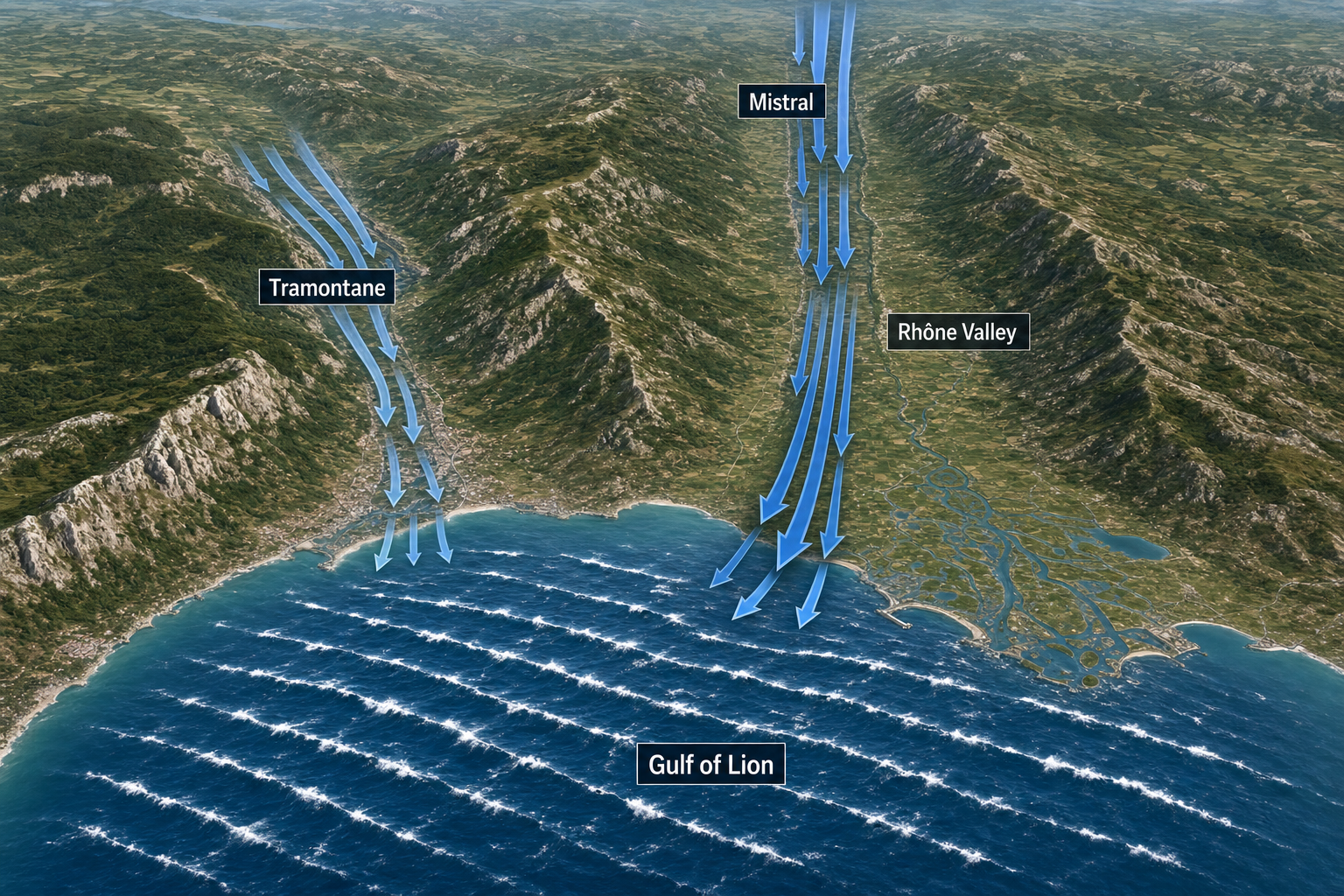
On a weather map, a classic Mistral setup shows high pressure over western or central Europe and low pressure over the Gulf of Genoa, the Tyrrhenian Sea, or northern Italy. Isobars are tightly packed from France into the western Mediterranean. The air is often cold behind a front, and the pressure gradient can be very sharp. Monitoring barometric pressure trends at the coast can give you useful early warning — a wireless indoor/outdoor weather station makes it easy to track pressure changes in real time.
Typical swell direction: north to northwest.
Typical surf height: 1 to 4 meters at exposed coasts; larger in severe events.
Typical period: 6 to 10 seconds; occasionally 11 seconds.
Best areas: Sardinia, Corsica, the Balearics, and selected western Italian coasts.
Wave quality: often stormy at exposed areas during the blow, but excellent in sheltered breaks once the wind eases.
Libeccio and Ponente Waves in the Tyrrhenian and Ligurian Seas
Libeccio is a southwest wind, while Ponente is a westerly. Both are common around Italy, Corsica, and Sardinia during frontal systems. They often form ahead of or around Mediterranean lows, especially Genoa lows and systems tracking eastward from the Balearic region.
On the map, look for a low near the Gulf of Genoa, northern Tyrrhenian Sea, or central Mediterranean. A front often crosses Italy, with southwest winds in the warm sector and west to northwest winds behind it.
Typical swell direction: west to southwest.
Typical surf height: 1 to 4 meters at exposed breaks.
Typical period: 7 to 11 seconds.
Best areas: west-facing Italy, Corsica, Sardinia, and Sicily.
Wave quality: can be very good when the wind swings offshore after the front passes.
Sirocco and Jugo Waves in the Adriatic and Central Mediterranean
The Sirocco, called Jugo in parts of the Adriatic, is a warm and humid southeast to south wind. It often blows ahead of a low-pressure system moving through the western or central Mediterranean. Because the Adriatic is long and narrow, a southeast wind can travel along its full length and generate surprisingly strong waves.
A Sirocco weather map usually shows low pressure to the west or northwest of the target area — often near the Gulf of Genoa or the central Mediterranean — with higher pressure sitting farther east or northeast. The isobars run along the Adriatic or Ionian Sea, creating a long southeast fetch.
Typical swell direction: southeast to south.
Typical surf height: 1 to 4 meters; bigger in strong Adriatic events.
Typical period: 6 to 10 seconds.
Best areas: the Adriatic, Ionian Sea, Malta, Sicily, and parts of Greece.
Wave quality: often messy during the wind, then cleaner when the low moves and winds turn west or north.
Bora Waves in the Adriatic Sea
The Bora is a cold northeast wind that accelerates from the Balkans toward the Adriatic. It can be extremely gusty because it spills over mountains and funnels through terrain gaps. While the Bora doesn’t always produce a long fetch, its strength can quickly build steep, powerful wind swell. Measuring local wind speed directly is one of the most practical forecasting tools you have — a handheld anemometer gives you an accurate real-time reading at the beach.
On a weather map, a Bora setup often shows strong high pressure over central or eastern Europe and low pressure over the southern Adriatic, Ionian Sea, or Aegean region. The isobars angle from northeast to southwest across the Adriatic.
Typical swell direction: northeast to east.
Typical surf height: 0.8 to 3 meters; larger in exposed zones.
Typical period: 5 to 8 seconds.
Best areas: Italy’s Adriatic coast and selected sheltered corners of the eastern Adriatic.
Wave quality: short-period and steep, but good where local wind is offshore or blocked by land.
Levante and Easterly Waves in the Western Mediterranean
Levante is an easterly wind affecting the Strait of Gibraltar, Alboran Sea, and southern Spain. Easterly patterns can also affect eastern Spain and the Gulf of Valencia. These events are important because they can create surf on coasts that sit completely flat under Mistral or westerly patterns.
On a map, look for high pressure north of the western Mediterranean and lower pressure over North Africa or the Alboran Sea. The pressure gradient drives easterly flow across the sea.
Typical swell direction: east to northeast.
Typical surf height: 0.8 to 3 meters.
Typical period: 6 to 9 seconds.
Best areas: eastern Spain, the Balearics, and parts of the Alboran Sea.
Wave quality: often best as the wind weakens or turns slightly offshore.
Meltemi Waves in the Aegean Sea
The Meltemi, also known as the Etesian wind, is a persistent north to northeast summer wind in the Aegean. It forms when high pressure over the Balkans interacts with lower pressure over Turkey and the eastern Mediterranean. It is not a classic storm system, but it can blow hard for days at a stretch.
The weather map often shows a broad north-south pressure gradient rather than a deep low. Isobars are packed over the Aegean, and the wind funnels between the Greek islands.
Typical swell direction: north to northeast.
Typical surf height: 0.5 to 2 meters; sometimes larger in exposed channels.
Typical period: 4 to 7 seconds.
Best areas: exposed Aegean islands, Crete, and parts of western Turkey.
Wave quality: usually windy and short-period, but sheltered setups can still be fun.
Cyprus Lows and Eastern Mediterranean Winter Waves
In winter, the eastern Mediterranean produces surf through Cyprus lows and related low-pressure systems. These systems can create west, southwest, or northwest swell depending on their track. They are especially important for Cyprus, Turkey, Lebanon, and Israel. A typical map shows low pressure near Cyprus, southern Turkey, or the Levantine Basin. Cold air often follows the front, and when the wind field aligns across the Levantine Basin, the surf can be surprisingly powerful. Staying updated on marine weather alerts during these events is important — a handheld VHF marine radio keeps you connected to real-time weather broadcasts when you’re near or on the water.
Typical swell direction: west to northwest, or southwest depending on the low track.
Typical surf height: 1 to 4 meters.
Typical period: 7 to 11 seconds.
Best areas: Cyprus, the Levant coast, southern Turkey, and exposed eastern Mediterranean beaches.
Wave quality: often improves after the front passes and local winds turn offshore.
Medicane Waves in the Mediterranean Sea
Medicanes are rare Mediterranean tropical-like cyclones. They usually form in autumn or early winter when an upper-level low sits over relatively warm water. They are compact systems, so their swell can be powerful but highly localized.
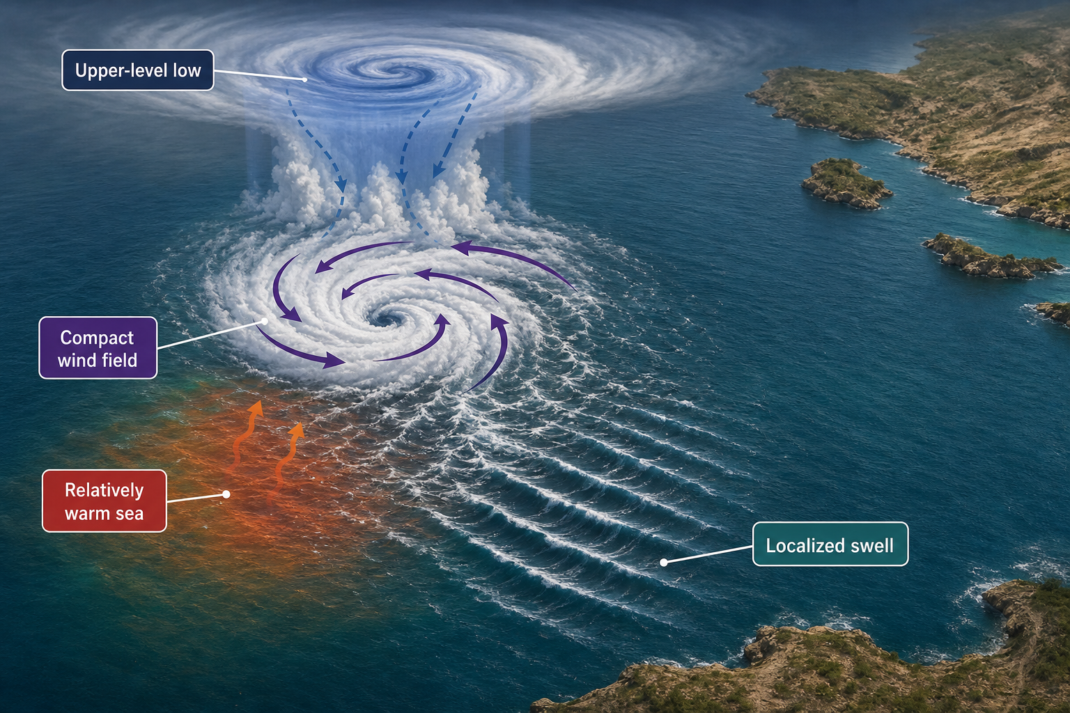
On satellite images, a medicane may show spiral bands and sometimes an eye-like feature. On a pressure map, it appears as a small circular low with tightly packed isobars. Unlike broad winter lows, a medicane may produce strong swell in one area while nearby coasts receive much less energy.
Typical swell direction: variable and rotating around the storm.
Typical surf height: 2 to 6 meters in affected zones.
Typical period: 8 to 12 seconds; occasionally higher.
Best areas: depends entirely on the storm track.
Wave quality: unpredictable, with rapid changes in wind and direction.
Mediterranean Sea Wave Conditions by Season
| Season | Main Wave Sources | Typical Height | Typical Period | Common Quality |
|---|---|---|---|---|
| Winter | Mistral, Bora, Sirocco, Cyprus lows, Genoa lows | 1 to 4 m; larger in major storms | 7 to 12 s | Most consistent season; best after fronts |
| Spring | Frontal lows, Mistral, Sirocco, easterlies | 0.5 to 2.5 m | 6 to 9 s | Variable but often clean between systems |
| Summer | Meltemi, thermal winds, occasional easterlies | 0.3 to 1.5 m; larger in Meltemi zones | 4 to 7 s | Least consistent; often wind affected |
| Autumn | First strong lows, Sirocco, Mistral, medicanes | 1 to 4 m | 6 to 11 s | Often excellent; warm water and active storms |
Weather, Temperature, and Pressure Factors Behind Mediterranean Sea Waves
Low Pressure and Storm Waves
Most strong Mediterranean surf comes from low-pressure systems. Air spirals inward around a low, and in the Northern Hemisphere it rotates counterclockwise. The strongest waves are usually generated where the pressure gradient is tightest and the wind blows over the longest fetch.
A moderate Mediterranean low may have a central pressure near 1000 to 1010 hPa. Stronger winter systems can fall below 995 hPa. The exact pressure is less important than the gradient — a 1002 hPa low sitting next to a 1032 hPa high can produce stronger winds than a deeper low surrounded by weak pressure differences. A marine barometer is a handy tool for tracking these gradient shifts at the coast, and learning the terminology behind them is easier with a reference like this weather terms dictionary.
Cold Air Over Warm Water
Autumn and winter are productive because relatively warm sea water sits below colder air masses. This increases instability, helps mix stronger winds down to the surface, and supports squalls around fronts. The result can be a fast-building sea state with steep, energetic waves.
Autumn is especially interesting because the sea is still warm after summer. Early-season lows can deepen quickly, and storms may produce strong surf before water temperatures drop. In winter, colder air outbreaks behind fronts are a major driver of Mistral, Tramontane, and Bora events.
Topography and Wind Acceleration
The mountains around the Mediterranean shape the wind in a significant way. The Alps, Pyrenees, and Dinaric Alps create channels where air accelerates far beyond what the broad pressure pattern suggests. This is why regional winds can be dramatically stronger at the coast than a standard model might indicate.
The Rhône Valley focuses the Mistral into the Gulf of Lion. The Dinaric Alps help produce the Bora. The Greek islands and Turkish coast funnel the Meltemi through the Aegean. For forecasting, local topography can be just as important as the storm itself. Deepening your understanding of how the ocean and atmosphere interact is worthwhile — this oceanography textbook covers the physical principles behind wave generation, ocean circulation, and atmospheric forcing in accessible detail.
What Mediterranean Wave-Making Storms Look Like on a Weather Map
Tight Isobars Mean Strong Winds
Isobars are lines of equal pressure. When they are close together, the pressure gradient is strong and the wind is likely to be stronger. For surf forecasting, look for tight isobars over water, not just over land — a strong wind field over land will not generate swell unless it reaches the open sea.
The most useful maps show sea-level pressure, 10-meter wind, and frontal positions. Upper-level charts can also help, because a deep trough aloft often supports surface cyclogenesis. Getting comfortable reading these charts takes practice, and a resource like this nautical chart guide can help you interpret pressure patterns and coastal geography together. When you’re working with printed charts or maps outdoors, a waterproof map case keeps them readable in wet or windy conditions.
Classic Mediterranean Surf Map Patterns
Mistral map: high pressure over France or the Bay of Biscay, low pressure near Genoa or the Tyrrhenian Sea, and tight northwest isobars across the Gulf of Lion.
Sirocco map: low pressure west of the Adriatic or central Mediterranean, higher pressure to the east, and southeast isobars running along the Adriatic or Ionian Sea.
Bora map: strong high pressure over central Europe, low pressure over the southern Adriatic or Ionian region, and northeast flow dropping from the Balkans.
Meltemi map: high pressure over the Balkans, lower pressure over Turkey or the Levant, and persistent north flow through the Aegean.
Medicane map: compact circular low, tight isobars, curved rain bands, and a small but intense wind field around the center.
How to Forecast Mediterranean Sea Waves From Regional Storms
Step 1: Know the Exposure of the Break
Before looking at the storm, know which swell directions the break can actually receive. Mediterranean coastlines are heavily shadowed by islands, capes, and peninsulas. A break that faces west may be completely blocked from northwest swell but wide open to southwest swell. A small change in swell direction can decide whether a spot is flat or overhead.
Step 2: Find the Fetch on the Weather Map
Look for a wind field blowing over water toward the exposure window of the break. The best fetch is broad, strong, and aligned with your target coast. If the wind bends away from the coast or crosses the fetch at an angle, less swell will arrive. A training chart like the NauticEd coastal navigation chart can help you practice reading fetch corridors and understanding how sub-basin geometry affects wave propagation.
For Mediterranean surf, a useful fetch may be 150 to 300 kilometers. A strong event may use 400 to 800 kilometers. The rare, standout events occur when a storm aligns with the full length of a sub-basin, such as the Adriatic or the western Mediterranean corridor.
Step 3: Estimate Height and Period
If the wind is under 20 knots, expect small and weak waves unless the event lasts a long time. If the wind is 25 to 35 knots over several hundred kilometers, expect proper short-period surf. If the wind exceeds 40 knots and lasts 12 hours or more, large surf is possible at exposed coasts.
For period, use fetch and duration as your guides. Short local winds produce 4 to 6 seconds. Organized regional storms often produce 7 to 10 seconds. Strong, slow-moving lows with a long fetch may reach 11 to 12 seconds.
Step 4: Time the Swell Arrival
Because Mediterranean storms are nearby, swell arrival can be fast. Use the rough deep-water travel rule: multiply the period by 2.8 to estimate swell speed in kilometers per hour. An 8-second swell generated 300 kilometers away may take roughly 13 to 14 hours to arrive.
In many cases, the sea builds while the storm is still blowing. The best surf may not happen at peak wind — it often comes several hours later, when the swell remains but local wind conditions improve.
Step 5: Forecast Local Wind and Clean-Up Windows
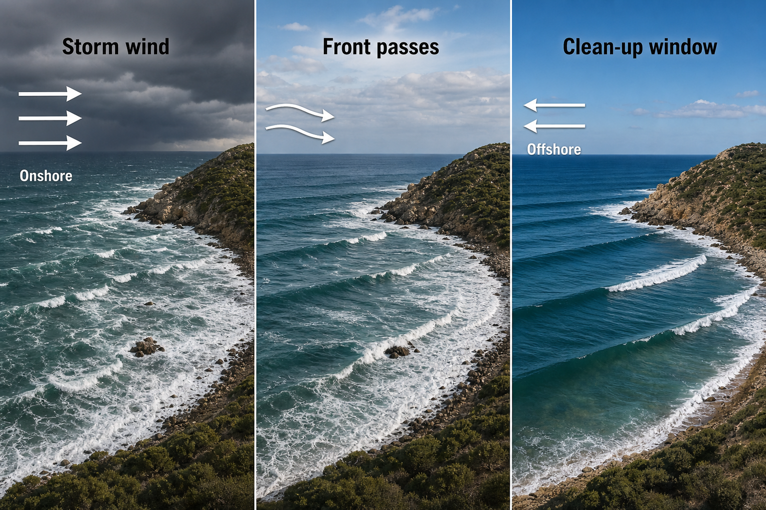
Wave size is only half the forecast. Mediterranean surf quality depends heavily on local wind because swell periods are usually short. Onshore wind can quickly make waves ragged and messy. Offshore or cross-offshore wind can transform a short-lived swell into a high-quality session.
Look for the moment after a front passes and the wind shifts. Also watch for dawn lulls, land breezes, and sheltered breaks behind headlands. In the Mediterranean, these brief clean windows are often the best part of any swell. If you’re logging your sessions and tracking which conditions produced the best results, a dedicated surf journal makes it easy to build a personal record over time.
Step 6: Check Models, Buoys, and Real-Time Observations
Wave models are useful, but local validation is essential. Compare several forecast model runs to see whether the storm track is stable. Check buoy data for height, period, and direction. Use coastal wind stations to confirm whether the expected wind shift has arrived. A NOAA emergency weather radio can provide real-time alerts and marine weather updates when you’re at the coast and away from a reliable data connection.
For Mediterranean forecasting, high-resolution regional wind models are often more useful than broad global models. Small errors in wind direction can matter significantly because the fetch is short and coastlines are complex.
What Makes a High-Quality Mediterranean Sea Swell
The best Mediterranean surf usually comes from a balance of storm energy and local protection. A powerful low must generate enough swell, but the target break also needs a favorable wind window. Since periods are shorter than open-ocean swell, Mediterranean waves are more sensitive to local chop and bathymetry than their Atlantic counterparts.
Good setups tend to share the same traits:
- A strong wind field over water for at least 12 hours.
- A fetch aligned with the break’s exposure window.
- A post-storm wind shift that turns offshore.
- Enough period for the swell to wrap or organize.
- A reef, point, or sandbar that handles short-period energy well.
Autumn and winter offer the highest odds because storms are stronger and more frequent. Spring can also be excellent when frontal systems arrive with cleaner winds behind them. Summer is generally smaller, although the Meltemi and regional thermal patterns create surf in the right locations for those willing to hunt for it.
Forecasting Mediterranean waves is less about waiting for distant groundswell and more about understanding the regional weather machine. Learn the storm types, match their wind fields to your local exposure, and watch for that brief window when swell and conditions line up. The sea may be enclosed, but with the right pressure pattern and the knowledge to recognize it, the Mediterranean can deliver memorable surf that rewards careful, patient forecasting.