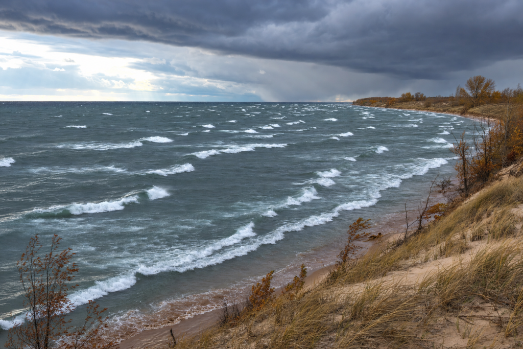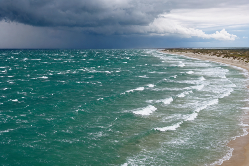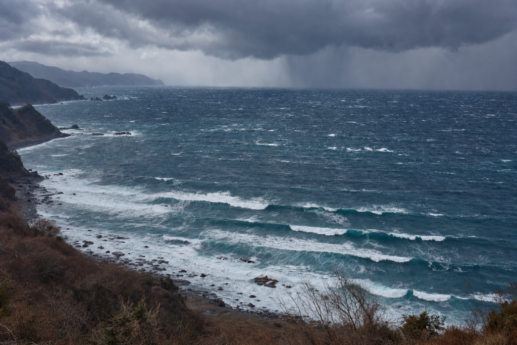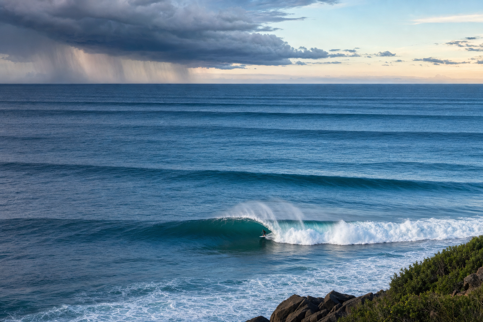
Every surfable wave begins as wind energy moving across the ocean. A local breeze can kick up short, peaky waves, but the memorable swells that light up coastlines often travel from powerful storms hundreds or thousands of miles away. Understanding how storms generate surfable waves is one of the foundations of surf forecasting. It explains why one storm produces clean, long-period lines while another creates disorganized chop, and why two beaches can react completely differently to the same swell. If you want to go deeper on this subject, this surf forecasting guide covers the connection between ocean conditions and wave behavior in detail. Keeping a surf journal to log swell conditions alongside your sessions is also a great way to build pattern recognition over time.
How Storms Generate Surfable Waves
Storm waves form when wind blows across the sea surface and transfers energy into the water. At first, small ripples appear. These ripples give the wind something to push against, allowing more energy to enter the ocean. As the wind continues, the ripples grow into waves, and eventually into an organized sea state made up of many wave sizes and periods.
A storm does not create one single wave. It creates a spectrum of wave energy — short-period waves, medium-period waves, and longer-period waves all radiating outward from the storm. As that energy leaves the storm area, the waves begin to sort themselves out. Longer-period waves travel faster, outrun the shorter ones, and can cross entire ocean basins as swell.
For surfers, the key question is not simply whether a storm is strong. The surf potential depends on how well the storm’s wind speed, fetch, duration, size, and direction work together.
Wind Speed and Swell Generation
Wind speed is the most obvious ingredient in swell generation. Stronger winds transfer more energy into the ocean, creating larger waves with longer periods. A light breeze may only roughen the surface, while gale-force winds can build powerful seas capable of producing significant surf at distant coastlines.
In general, higher wind speeds produce:
- Greater wave height, because more energy is pushed into the water.
- Longer wave periods, because stronger winds can sustain larger, more powerful wave growth.
- More swell energy overall, especially when the wind blows over a large area for long enough.
Wind speed alone, however, does not guarantee a good swell. A compact but intense storm may generate very large seas near its center, yet if the wind field is small or poorly aimed, the swell can arrive weak or inconsistent. A broader storm with slightly lower wind speeds can sometimes produce better surf because it acts on a larger patch of ocean and sends more energy toward the coast. To understand how meteorologists read these systems, a weather terms reference can help decode the language used in marine forecasts.
Why Storm Strength Matters for Swell Size
Storm strength is closely tied to pressure differences in the atmosphere. A deep low-pressure system sitting next to a strong high-pressure system creates a tight pressure gradient, which drives stronger winds. The stronger and broader that wind field, the more wave energy the storm can generate.
For surf forecasting purposes, the best storms are usually not just intense at the center. They also have a large area of strong winds aimed toward the coastline. A storm with a wide swath of 35-knot winds may produce a more reliable swell than a compact storm with a small pocket of 50-knot winds, especially for surf zones far from the source. Tracking barometric pressure shifts can help you anticipate storm intensity. A marine barometer is a simple and practical tool for monitoring pressure changes at your local break.
Fetch: The Ocean Runway Where Swell Is Built
Fetch is the uninterrupted distance over water that wind blows in the same general direction. Think of it as the runway where waves gather energy. The longer the runway, the more time and space the wind has to build up the sea state.
A short fetch limits wave growth. The wind may be strong, but if it only blows over a small area, waves cannot reach their full potential. A long fetch allows wave height and period to increase significantly, especially when wind direction remains steady throughout.
How Fetch Length Affects Wave Height and Period
As wind blows across the ocean, waves grow until they are limited by one of three factors: wind speed, fetch length, or storm duration. If the fetch is too short, the sea is called fetch-limited, meaning the wind could build larger waves if it had more ocean surface to work with.
Longer fetches generally produce:
- Larger seas inside the storm, because waves stay under wind influence for longer.
- Longer-period swell, because wave energy has more room to organize and grow.
- More consistent surf, because a larger area of ocean is sending energy toward the coast.
Fetch quality matters as much as fetch length. If winds change direction frequently, the energy scatters. If the wind blows steadily along a clean, uninterrupted path, the resulting swell tends to be better organized.
Storm Duration and Why Long-Lasting Storms Make Better Swell
Duration is the amount of time wind blows over the same area of ocean in the same general direction. A storm needs time to build waves. Even very strong winds may not produce a major swell if they only last a few hours.
When winds persist, waves keep receiving energy. Wave height increases, period lengthens, and the swell becomes more powerful. If the wind lasts long enough over a sufficient fetch, the sea may become fully developed — meaning waves have grown as large as they can for that wind speed, given adequate distance and time.
Duration-Limited Swell
A swell is duration-limited when the wind stops or changes direction before waves reach their potential size. This is common with fast-moving storms. They may look impressive on a weather chart, but if their strongest winds don’t remain aimed at the same swell window for long, the resulting surf can underperform.
Long-lasting storms tend to produce more reliable surf because they send multiple pulses of energy toward the coast. Instead of one short burst, the coastline receives a longer run of waves with better consistency and a more defined peak in the swell.
Why Storm Direction and Alignment Are Critical
A storm must send energy toward a surf spot for that spot to receive swell. This sounds straightforward, but it is one of the main reasons surf forecasts vary so much between regions. A powerful storm in the wrong part of the ocean may produce excellent waves for one coastline and almost nothing for another.
The most important factor is the direction of the storm’s winds, not just the location of the storm center. Swell radiates away from the area where strong winds are blowing. If those winds point into a coastline’s swell window, the surf potential is high. If they point away, the energy may miss the region entirely. Staying aware of developing storm systems is easier with a handheld VHF marine radio that receives NOAA weather alerts, especially if you’re surfing in a remote area.
Swell Windows and Storm Alignment
A swell window is the range of ocean directions from which a surf spot can receive swell. Some beaches have wide-open ocean exposure. Others are blocked by headlands, islands, or landmasses.
A storm is well aligned when its strongest winds blow along a path that points into the swell window of the target coast. Better alignment means more energy reaches the surf zone. Poor alignment means the swell arrives smaller, less consistent, or not at all.
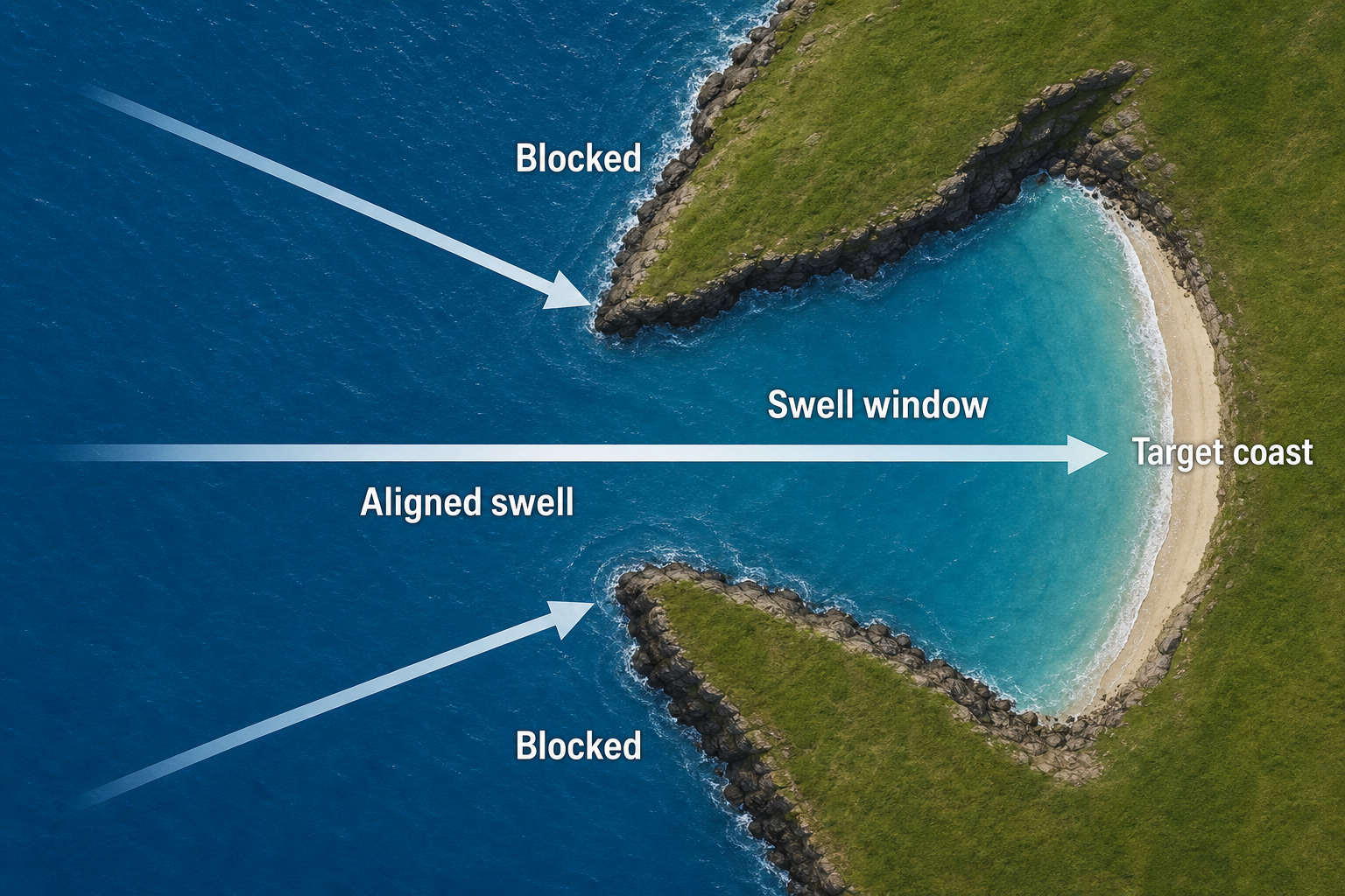
For example, a west-facing beach may need swell from the west or northwest. If a storm’s strongest fetch is aimed south of that beach, the swell may pass by offshore. A nearby coastline with a different orientation could receive excellent waves from the same storm.
Captured Fetch: When a Storm Moves With the Swell
One of the most powerful swell-producing setups is called captured fetch. This happens when a storm moves in roughly the same direction as the waves it is generating. As the swell travels forward, the storm’s winds keep pushing from behind, feeding more energy into the waves over time.
Captured fetch can produce unusually large and long-period swell because the waves stay under the influence of strong wind longer than they would with a stationary system. This is one reason certain storm tracks become well known among forecasters: they combine strength, duration, and forward movement all aimed toward the target coastline.
Why Stronger, Longer-Lasting, Better-Aligned Storms Produce Larger and Cleaner Swells
The best swells usually come from storms that combine several favorable ingredients. Strong winds create energy. Long fetch gives that energy space to grow. Long duration gives waves time to build. Good alignment directs the energy toward the coast.
When these ingredients work together, the storm generates long-period swell. Long-period waves are important because they travel faster, carry more energy below the surface, and typically produce more powerful breaking waves when they reach shallow water.
Why Larger Swell Is Not Just About Wave Height
In surf forecasting, a “bigger” swell is not purely about offshore wave height. A 6-foot swell at 16 seconds carries significantly more energy than a 6-foot swell at 8 seconds. Period strongly affects how waves feel and break.
Longer-period swell tends to:
- Break with more power, because the wave energy reaches deeper into the water column.
- Refract more strongly, which can focus energy onto reefs and points.
- Create longer, more defined lines, especially after traveling far from the generating storm.
This is why experienced surfers pay close attention to swell period, not just swell height. A modest long-period swell can produce surprisingly powerful surf, while a larger short-period swell may look weak or choppy on arrival.
Why Cleaner Swell Forms With Distance
As swell travels away from a storm, the ocean acts like a natural filter. Long-period waves move faster than short-period waves, so they separate over distance. The first waves to arrive from a distant storm are often long-period forerunners. Later, the main body of the swell fills in, followed by shorter-period energy trailing behind.
This sorting process creates more organized swell lines. The chaotic sea inside the storm gradually becomes cleaner as it spreads across the ocean. By the time it reaches a distant coastline, what was once stormy confusion can arrive as well-spaced, readable sets.
This doesn’t mean every distant swell is perfect. Local winds, tides, bathymetry, and coastline shape all still play a role. But all else being equal, a well-traveled swell is usually more organized than local wind swell.
Wind Swell Versus Groundswell
Surfers generally divide swell into two broad categories: wind swell and groundswell. The difference goes beyond where the swell comes from. It also involves period, organization, power, and how the waves break at the shore.
What Is Wind Swell?
Wind swell is produced by nearby winds, often close to the surf spot itself. It usually has a shorter period, commonly in the range of 5 to 10 seconds. Because the waves haven’t traveled far, they have had less time to sort into clean, organized lines.
Wind swell often produces surf that is:
- Peaky and unpredictable, with waves breaking in multiple spots at once.
- Inconsistent in shape, especially if local wind is still active on the water.
- Less powerful, because short-period waves carry less energy into deep water.
Wind swell can still be enjoyable. Beach breaks often respond well to shorter-period energy, producing punchy peaks rather than long, walled-up lines. In regions without consistent exposure to distant storms, wind swell may be the primary source of surf for much of the year.
What Is Groundswell?
Groundswell is swell that has traveled well away from its generating storm, often across a large stretch of open ocean. It typically has a longer period, commonly 11 seconds or more, though there’s no rigid cutoff. Long-period groundswell can arrive from storms thousands of miles away.
Groundswell usually produces better surf because it is more organized and more powerful. The waves arrive in defined sets with clean spacing between them. They also interact more strongly with the seafloor, which helps them wrap into points, focus on reefs, and bend into sheltered bays. To get a broader picture of where swells originate globally, a world atlas is a surprisingly useful reference for visualizing storm tracks and ocean basins.
Why Groundswell Usually Produces Better Surf
Groundswell is often preferred because it has gone through natural filtering during travel. Shorter-period waves fall behind while longer-period waves move ahead in orderly bands. This creates a cleaner, more readable ocean surface by the time the swell reaches the shore.
Longer-period swell also has a deeper reach in the water column. In deep water, wave energy extends to a depth related to wavelength. Longer-period waves have longer wavelengths, so they begin to feel the seafloor farther offshore. This allows them to refract, shoal, and organize before they break.
That extra organization can create high-quality surf, but it can also expose the limitations of a break. Some beaches close out on long-period swell because the waves arrive in long, straight lines with no variation. Other spots come alive only when the period is long enough for the swell to wrap around a headland or focus onto a reef.
How Storm Tracks Determine Swell Direction and Arrival Timing
A storm track is the path a storm follows across the ocean. Storm tracks matter because they determine where the strongest winds occur, how long they remain aimed at a coastline, and what direction the swell will travel when it arrives.
Forecasters don’t just look at the storm’s position on a chart. They track how the wind field evolves over time. A storm may begin with a fetch aimed at one coastline, then rotate or shift so the fetch points somewhere else entirely. This can produce different swell pulses from a single storm system.
Storm Movement and Changing Swell Direction
As storms move, their wind direction changes relative to different coastlines. A low-pressure system rotating over the ocean may send one pulse from the southwest, then another from the west, then another from the northwest as it tracks across the sea. Each pulse can arrive at a different time and interact differently with local breaks.
This is why a forecast may show a swell “shifting direction” over several days. The ocean is receiving energy from different parts of the same storm at different times. Even a slight directional shift can have a large effect if a surf spot sits near the edge of its swell window.
Great-Circle Paths and Swell Travel
Swell generally travels along great-circle paths, which are the shortest routes across the curved surface of the Earth. On a flat map, these paths can appear curved, making the apparent travel direction misleading. Modern surf forecast models account for this when estimating swell direction and arrival time.
Great-circle travel also explains why remote storms can affect coastlines that seem surprisingly far out of the way. A Southern Ocean storm, for example, can send long-period swell into the Pacific, Indian, or Atlantic depending on its position and the direction of its wind field. Understanding how to read nautical and coastal charts adds real depth to this kind of analysis. A guide to reading nautical charts or a coastal navigation chart can help you interpret swell angles and coastline geometry more accurately.
Reading Swell Arrival From Period and Distance
Swell does not arrive all at once. Because ocean waves are dispersive, longer-period waves travel faster than shorter-period ones. In deep water, swell group speed is roughly proportional to wave period. A 20-second swell travels much faster than a 10-second swell, so the first signs of a distant storm are usually long-period forerunners arriving many hours before the main energy.
A useful rule of thumb: in deep water, swell group speed is approximately 1.5 times the period in knots. A 16-second swell travels at roughly 24 knots, while a 10-second swell moves at around 15 knots. Distance from the storm matters just as much. A storm 1,000 nautical miles away can deliver swell quickly, while a storm 5,000 nautical miles away may take several days to send its main energy. This is why a forecast might call for a swell to show late in the day, peak overnight, and ease by the following morning.
Why Swell Peaks Can Be Hard to Time
Even with good forecast models, swell timing is never exact. Storms change shape, wind fields expand or contract, and different parts of the fetch send energy from different distances. Buoys may show a swell earlier or later than expected depending on their position relative to the swell path.
Local bathymetry can also delay or transform how the surf appears. A long-period swell may register on an offshore buoy well before it produces good waves at a particular beach. Some spots need a specific tide, direction, or size threshold before the swell becomes obvious in the lineup.
From Open-Ocean Swell to Breaking Surf
Storm generation is only the first part of the forecast. Once swell approaches the coast, the seafloor reshapes it. This process determines whether open-ocean energy becomes a hollow reef wave, a lined-up point break, or a closing-out beach break.
Shoaling, Refraction, and Focusing
As swell enters shallower water, it slows down and grows taller — a process called shoaling. At the same time, different parts of the wave slow at different rates depending on the depth of the seafloor beneath them. This causes the wave to bend, a process known as refraction.
Refraction can either spread swell energy out or concentrate it. Reefs, underwater canyons, and headlands can focus long-period swell onto specific takeoff zones while leaving nearby beaches comparatively small. This is why swell direction is so important at the local level. A shift of just a few degrees can move the best waves from one peak to another, or turn a promising forecast into a disappointment at a spot that needs a precise angle to work. A good pair of compact binoculars can help you read the lineup from the shore before paddling out.
Why Local Wind Still Matters
A distant storm may generate an excellent groundswell, but local wind determines surface quality at your break. Offshore or light winds groom incoming swell into clean, glassy surf. Onshore winds add chop, crumble the lip, and reduce wave quality significantly. You can measure local wind conditions on the spot with a handheld anemometer, which gives you a quick read on wind speed and direction before you head out.
Local wind doesn’t usually create the main energy in a groundswell event, but it strongly affects how that energy looks when it breaks. A complete surf forecast always combines swell generation data with local wind, tide, and the specific behavior of your break.
How to Interpret Storms in a Surf Forecast
When looking at a storm on a forecast chart, it helps to work through a sequence of practical questions. The goal is to judge not just whether the storm is impressive, but whether it is likely to produce surf at your coast. A NOAA weather alert radio is worth keeping nearby so you can track system development without being glued to a screen, and a wireless weather station can give you a real-time snapshot of local conditions alongside the broader forecast picture.
Key Storm Features to Check
- Wind speed: Are the winds strong enough to generate meaningful swell?
- Fetch length: Is there a broad area of wind blowing over open ocean?
- Duration: Do the winds stay aimed in the same direction long enough to build a swell?
- Alignment: Is the fetch pointing into your swell window?
- Storm track: Is the system moving in a way that enhances or weakens the swell?
- Distance: Is the storm close enough for size, or far enough away for the swell to organize?
A strong storm with poor alignment may produce nothing at your local break. A moderate storm with excellent alignment and long duration can produce surprisingly good surf. The best forecasts come from weighing all of these ingredients together rather than fixating on any single number. For a more technical grounding in wave dynamics and ocean systems, this oceanography textbook is a thorough reference. If you spend time on the water navigating between breaks, a rugged handheld GPS can also be a practical companion.
What Buoys Reveal About Swell Generation
Buoys help confirm whether a storm has produced the expected swell. They report swell height, period, and direction in real time. A rising long-period reading often signals the first energy from a distant storm. If the period increases before the height does, the forerunners have arrived ahead of the main swell.
As the main swell fills in, height increases and the dominant period settles into the range produced by the storm’s strongest winds. If the buoy direction differs from the forecast, it may mean the storm’s fetch was aimed differently than models predicted, or that a second swell is mixing in from another source. Taking notes on buoy readings over time is one of the best habits a developing forecaster can build. A pack of weatherproof notebooks works well for jotting down conditions at the beach without worrying about spray or rain.
Why Some Storms Overperform and Others Disappoint
Surf forecasting would be straightforward if storm strength alone determined wave quality, but the ocean is more complicated than that. Some storms overperform because they move in perfect alignment with the swell direction, intensify at exactly the right time, or develop a larger fetch than models initially predicted.
Other storms disappoint because the strongest winds are aimed away from the coast, the system moves too quickly, or the fetch breaks apart before waves fully develop. Blocking by islands or continental landmasses can also strip significant energy from a swell before it reaches its destination.
Another common reason for disappointment is swell direction at the local level. A forecast may show sufficient height and period, but if the swell arrives from a poor angle, the target beach may be shadowed or the waves poorly shaped. Meanwhile, a nearby spot with better exposure may be firing from the same swell.
Storms generate surfable waves through a balance of power, time, distance, and direction. Strong winds start the process, but fetch and duration determine how much energy enters the ocean. Storm alignment decides where that energy goes, while storm track shapes both swell direction and arrival timing. Groundswell usually offers the cleanest and most powerful surf because it has traveled far enough to organize, but every coastline responds differently depending on its exposure and underwater topography. Once you understand how storms build swell, surf forecasts stop being just numbers on a screen and become a readable story of energy moving across the ocean toward the shore.