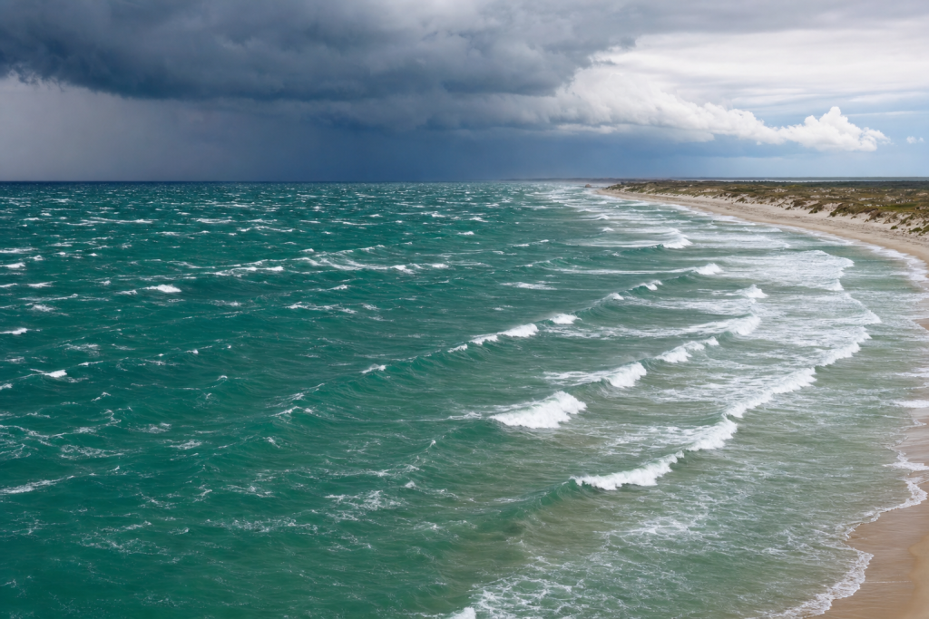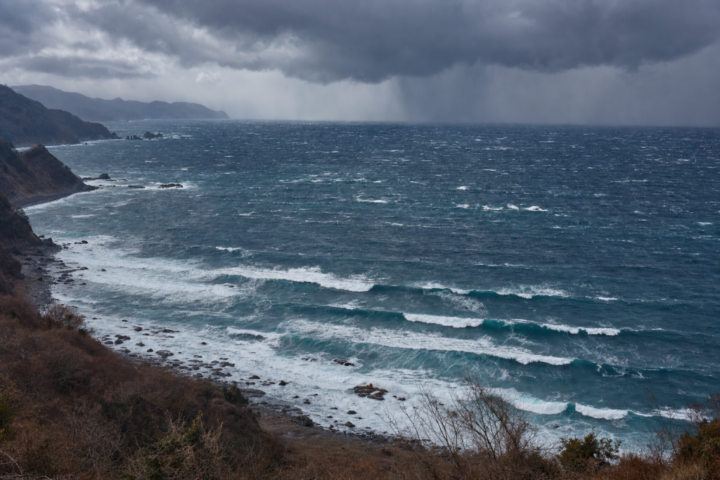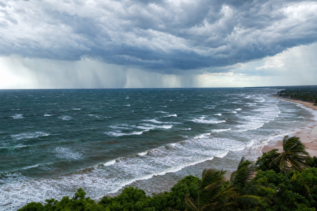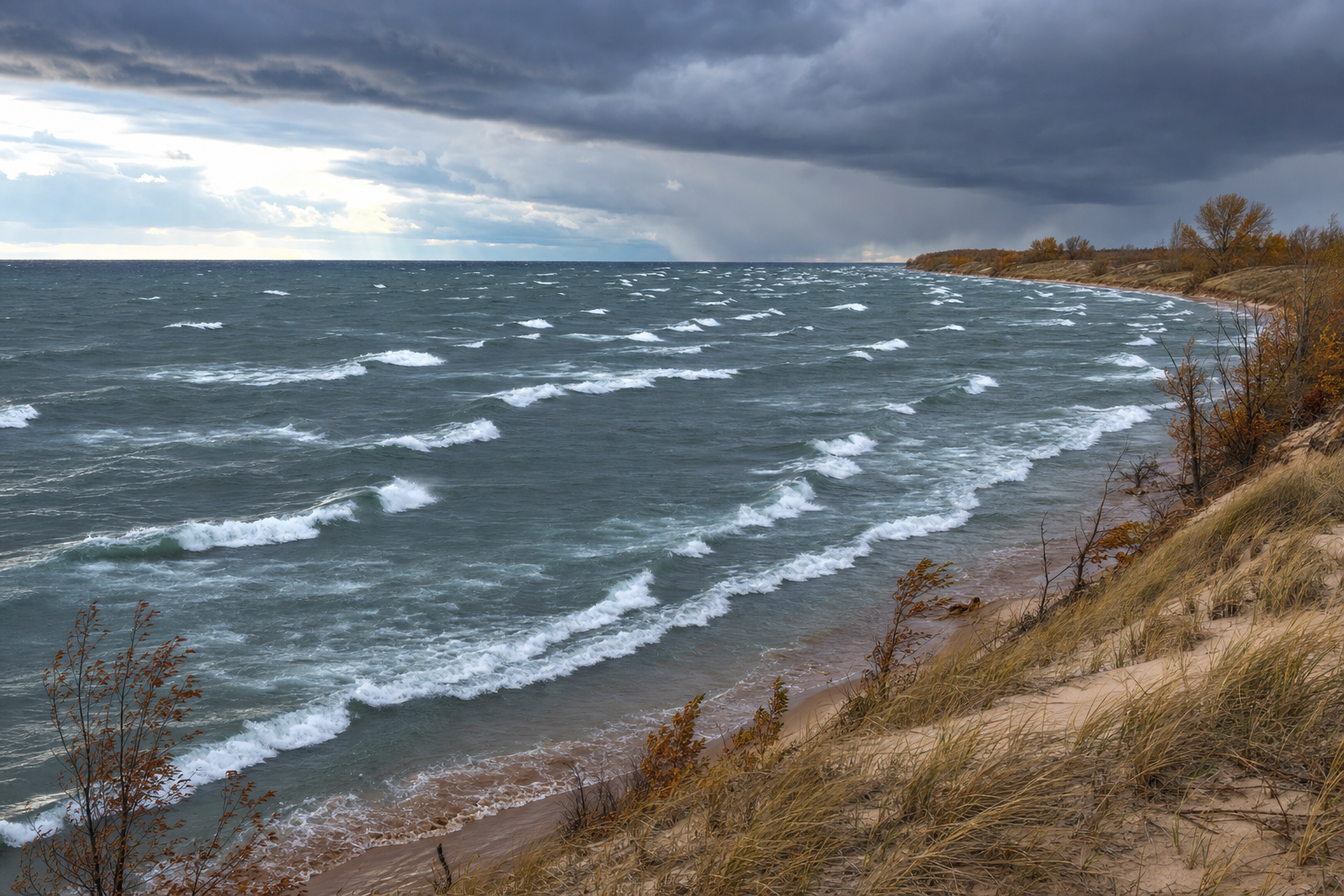
Great Lakes surf is created by weather, not distant ocean storms. Because the lakes are enclosed basins, waves are born close to shore from strong winds blowing across open water. That makes Great Lakes surf forecasting fast, local, and highly dependent on storm track. A low pressure system 100 miles north, a cold front arriving a few hours early, or ice covering part of the lake can turn a promising forecast into flat water—or produce clean, surfable waves at a spot that looked marginal the night before. If you want to go deeper on wave science and forecasting, a surf forecasting guide is a great place to start.
How Great Lakes Waves Are Generated
Most surfable Great Lakes waves are wind waves, often called wind swell by surfers. Wind transfers energy to the water surface through friction. The stronger and longer the wind blows over open water, the larger and more organized the waves become. Three ingredients control wave generation:
- Wind speed: Stronger wind creates larger waves.
- Fetch: The uninterrupted distance of open water over which wind blows.
- Duration: The length of time the wind blows from the same general direction.
In the ocean, long-period groundswell can travel thousands of miles after leaving its source storm. In the Great Lakes, available fetch is much shorter, so most waves have short to moderate periods. A typical surfable Great Lakes period runs about 4 to 8 seconds. Strong fall and winter gales can push periods toward 9 or 10 seconds, especially on the larger lakes. Understanding the basics of wave formation is easier with a solid background in ocean science—an oceanography textbook can help fill in the details.
Why Great Lakes Waves Are Short-Period and Steep
Great Lakes waves tend to feel punchy, stacked, and close together. This happens because the lakes are not wide enough for waves to fully separate by period. When wind is still blowing at the beach, the surf often looks jumbled because new waves are being created on top of older ones.
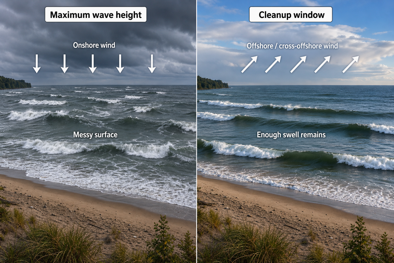
The cleanest surf often arrives during a wind shift. A storm may generate waves with strong onshore wind, then the wind turns offshore or cross-offshore as the low moves away. Because Great Lakes swell decays quickly, this cleanup window may last only a few hours.
Wave Height vs. Surf Height in the Great Lakes
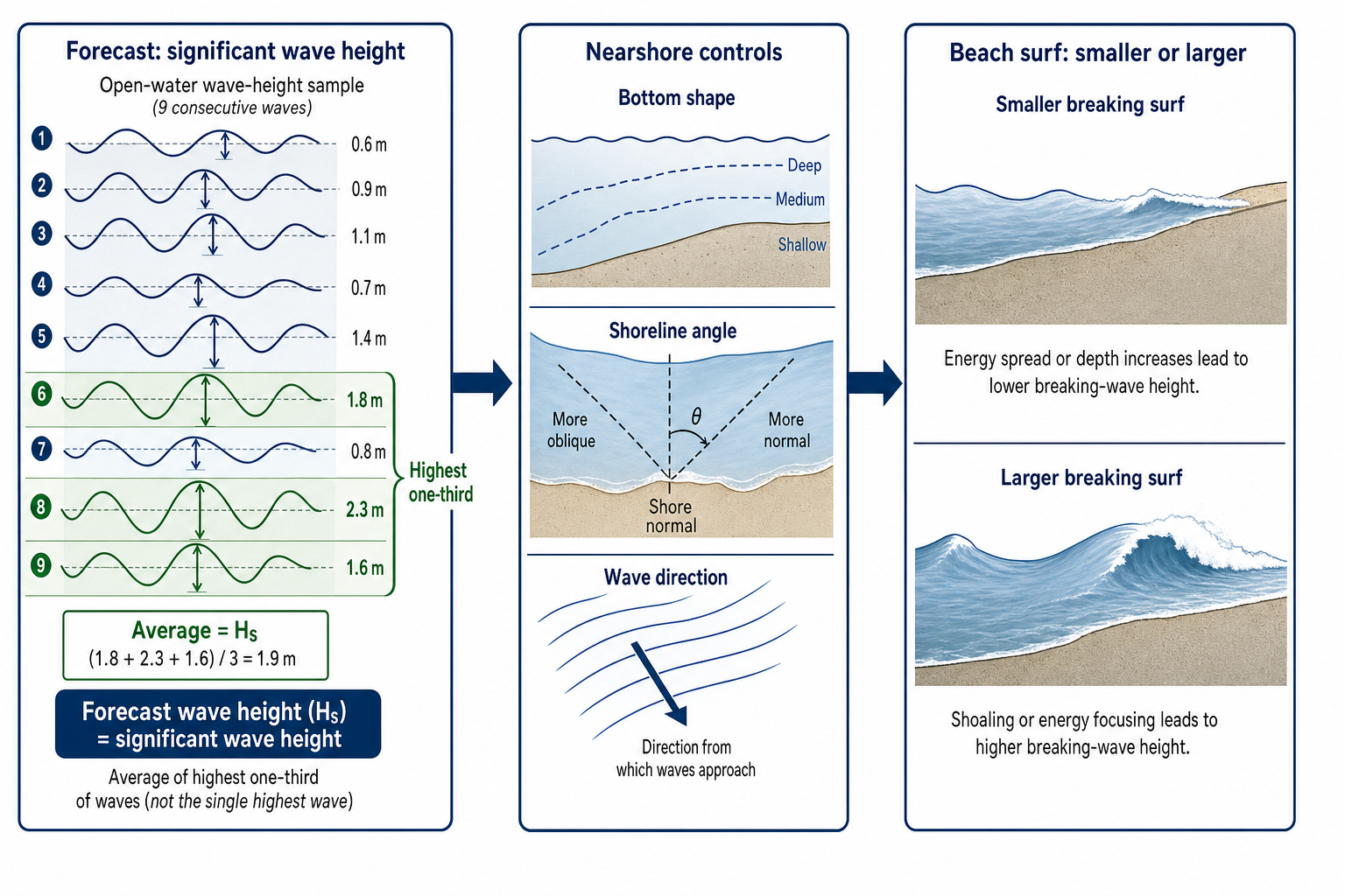
Forecast wave height usually refers to significant wave height, which is the average height of the highest one-third of waves in open water. Surf at the beach can be smaller or larger depending on bottom shape, shoreline angle, and wave direction.
As a rough guide:
| Wind speed over open water | Typical lake wave height | Typical period | Surf potential |
|---|---|---|---|
| 15–20 knots | 1–3 feet | 3–5 seconds | Small, weak, and very local |
| 20–30 knots | 3–6 feet | 4–7 seconds | Common surfable range |
| 30–40 knots | 5–10 feet | 6–9 seconds | Strong surf if fetch is aligned |
| 40+ knots | 8–15+ feet | 7–10 seconds | Major gale surf, often stormy at first |
The largest offshore storm seas on the biggest lakes can exceed these ranges, but nearshore surf quality depends on much more than size alone.
Fetch and Lake Shape: The Foundation of Great Lakes Swell Forecasting
Every Great Lakes surf forecast starts with the shape of the lake. The best waves happen when wind blows along a long axis of open water and sends swell toward an exposed shoreline. Knowing the geography of each lake is essential—a detailed world atlas can help you visualize fetch distances and lake orientations at a glance.
| Lake | Important fetch directions | Forecasting notes |
|---|---|---|
| Superior | West, east, north, northeast | The deepest and largest lake. It can produce the most powerful long-fetch waves, especially during fall gales. |
| Michigan | North, south, southwest, northwest | The north-south orientation makes it very sensitive to northerly and southerly wind events. |
| Huron | Northwest, north, southeast, northeast | A complex shoreline and numerous islands create strong shadowing and localized surf windows. |
| Erie | Southwest, west, northeast, east | Shallow water allows waves to build quickly, but they are often steep and short-period. |
| Ontario | West, southwest, east, northeast | Compact but productive, especially when wind aligns with its west-east orientation. |
Wave direction is named for where the waves come from. A north swell travels from north to south. A beach exposed to north swell needs open water to its north and minimal blocking by points, islands, or headlands.
Seasonal Great Lakes Wave Patterns
Great Lakes surf changes dramatically by season. The same 25-knot wind can produce very different results in April versus October because of water temperature, ice cover, air stability, and storm duration.
Spring Great Lakes Waves
Spring is a transition season. Strong low pressure systems still cross the region, but cold lake water can make surface wind forecasts tricky. When relatively warm air flows over cold water, the lower atmosphere becomes stable. That stability can prevent stronger winds aloft from mixing down to the lake surface.
| Common spring storms | Typical swell directions | Typical heights | Typical periods | Wave quality |
|---|---|---|---|---|
| Cold fronts | West to northwest | 2–6 feet | 4–7 seconds | Fast-building and often short-lived |
| Colorado or Plains lows | East to northeast before passage, west after | 3–8 feet | 5–8 seconds | Can be good if the wind shift creates a cleanup window |
| Late-season lake-effect setups | Northwest to north | 3–7 feet | 5–8 seconds | Steep, raw, and weather-dependent |
Spring forecasts need close attention to ice coverage and water temperature. Partial ice cover shortens fetch, while stable air over cold water can cause wave models to overestimate surf height.
Summer Great Lakes Waves
Summer is typically the weakest surf season. Pressure gradients are often relaxed, and most wave events come from thunderstorms or brief frontal passages. Warm water and warm air reduce the atmospheric instability that helps strong winds mix down to the surface in autumn.
| Common summer storms | Typical swell directions | Typical heights | Typical periods | Wave quality |
|---|---|---|---|---|
| Thunderstorm outflows | Variable | 1–4 feet | 2–5 seconds | Localized, inconsistent, and brief |
| Weak cold fronts | West, northwest, or north | 2–5 feet | 3–6 seconds | Often rideable but rarely powerful |
| Tropical remnants | East, northeast, or southwest | 3–8 feet | 5–8 seconds | Potentially good if the track is slow and organized |
Summer surf forecasting is often nowcasting. Radar, nearshore wind stations, and buoys matter more than long-range model output because summer storms can be small and fast-moving. A handheld marine VHF radio lets you pull live NOAA weather updates from the water, which is especially useful when conditions are changing fast.
Fall Great Lakes Waves
Fall is the prime Great Lakes surf season. The lakes still hold summer warmth while colder air masses begin sweeping out of Canada. This temperature contrast creates strong atmospheric instability over the water, which allows powerful winds aloft to mix down efficiently. Mid-latitude storms also become deeper and more frequent during this time of year.
| Common fall storms | Typical swell directions | Typical heights | Typical periods | Wave quality |
|---|---|---|---|---|
| Deep Great Lakes lows | Southwest, west, northwest, northeast | 5–12+ feet | 6–10 seconds | Best season for powerful and organized surf |
| Strong cold fronts | West to northwest | 4–10 feet | 5–9 seconds | Stormy at first, then potentially clean after the wind shifts |
| Slow eastern lows | East to northeast | 4–10 feet | 6–9 seconds | Long-duration swell with better organization |
The classic “November gale” pattern is a deep low tracking through the Great Lakes or into eastern Canada, with a strong high building behind it. Tight isobars over open water produce long-duration gale winds and large, fast-building waves. Keeping an eye on barometric pressure trends is one of the most reliable early indicators of an approaching event—a marine barometer makes it easy to track pressure changes at your local break.
Winter Great Lakes Waves
Winter brings some of the strongest wind events of the year, but surf forecasting becomes more complicated. Ice cover can dramatically reduce fetch. When the lakes stay open, arctic outbreaks can generate large waves with steep faces and short intervals.
| Common winter storms | Typical swell directions | Typical heights | Typical periods | Wave quality |
|---|---|---|---|---|
| Arctic cold fronts | West, northwest, or north | 4–10 feet | 5–9 seconds | Raw, powerful, and often wind-affected |
| Alberta clippers | West to northwest | 3–8 feet | 5–8 seconds | Fast-rising but often short-duration |
| Deep continental lows | Northeast before passage, northwest after | 5–12+ feet | 6–10 seconds | Potentially excellent if ice does not block fetch |
Open-water winters can be very productive. Heavy ice years can shut down otherwise ideal swell windows by cutting short the distance over which wind can build waves. In cold conditions, having a reliable way to receive weather alerts matters—a shore-based NOAA weather alert radio is a practical tool to keep at home or in the car during storm season.
Storm Types That Create Surfable Great Lakes Waves
Deep Low Pressure Systems
The most productive Great Lakes surf often comes from deep mid-latitude lows. These storms form along strong temperature contrasts and intensify as they move through the Midwest, the Great Lakes region, or into eastern Canada.
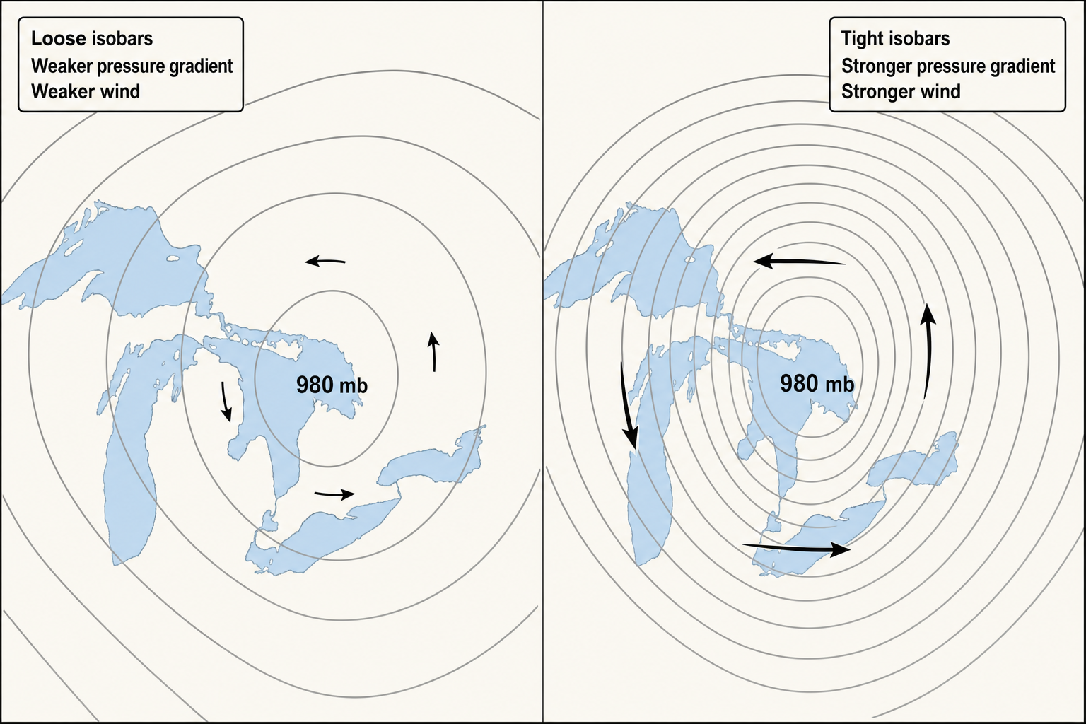
On a weather map, look for a low with tightly packed isobars surrounding it. The tighter the spacing, the stronger the pressure gradient and the stronger the surface wind. Near the surface, wind flows counterclockwise and slightly inward around low pressure in the Northern Hemisphere.
A deep low can produce several surf windows from the same storm. Ahead of the low, winds may blow from the east, northeast, or southwest. Behind the cold front, winds usually shift west or northwest. The best spot changes as the storm moves, so tracking the full storm track is essential.
Cold Fronts and Northwest Great Lakes Swell
Cold fronts are among the most common wave-makers on the lakes. Before the front passes, winds may blow from the south or southwest. After passage, colder air surges in and winds often turn west, northwest, or north.
These events can build surf quickly because cold air moving over warmer lake water creates atmospheric instability, which helps transfer stronger winds down to the surface. Cold front surf is usually messy while the wind is onshore, but quality improves when the wind veers side-offshore or offshore at exposed breaks before the swell fades.
Colorado Lows, Plains Lows, and Northeast Great Lakes Swell
Colorado lows and Plains lows are major Great Lakes wave producers. They often track from the central United States toward the lakes or the St. Lawrence Valley. On the north side of these systems, easterly and northeasterly winds can blow across long stretches of open water.
This setup matters because northeast and east swell can activate beaches that are flat during common west-wind events. If the low deepens slowly and stalls, the fetch can stay aligned for many hours, allowing waves to become more organized. On a weather map, look for low pressure south or southeast of the target lake with high pressure to the north—packed isobars running across the lake from east to west usually indicate a strong easterly or northeasterly fetch.
Alberta Clippers and Fast Wave Events
Alberta clippers are quick-moving lows that drop southeast out of western Canada. They are usually not as deep as major fall lows, but they can create sharp pressure gradients and fast bursts of west or northwest wind. Clipper surf tends to be brief—waves may build rapidly, peak for a short window, then fade as the system races away. These storms are most useful for exposed breaks that respond quickly to west or northwest wind.
Lake-Effect Wind Setups and Arctic Outbreaks
Lake-effect patterns are not only snow producers. They can also generate waves when cold air pours across open water behind a departing low. The key ingredients are an open lake surface, strong northwest or north wind, and a large temperature difference between air and water.
These waves are usually short-period and wind-driven, but they can be powerful when fetch is long enough. The most organized surf often appears on shorelines that receive the swell while being at least partially sheltered from the strongest local wind. Measuring actual wind speed at the shore is useful in these setups—a handheld anemometer gives you real wind data rather than relying on stations miles away.
Thunderstorms, Squall Lines, and Summer Surf
Thunderstorms can create waves through sudden outflow winds. A strong squall line may produce a quick pulse of surf, especially on smaller lakeside beaches that react fast to changing conditions. The limitation is duration. Even when thunderstorm winds are strong, they often blow from a useful direction for less than an hour, which creates short-period and disorganized waves rather than lasting swell.
Weather Factors That Control Great Lakes Wave Quality
Atmospheric Pressure and Pressure Gradient
Pressure itself is less important than the pressure difference over distance. A 980 millibar low can look impressive, but the waves depend on how tightly the isobars are packed across the lake. Tight isobars mean a strong pressure gradient and stronger wind. For surf forecasting, the best pressure pattern is not always the deepest storm—it is the storm that places the strongest, longest-lasting wind over the best fetch for your target break. Tracking barometric trends at home is simple with a wireless home weather station that monitors pressure, temperature, and forecast conditions in real time.
Air Temperature, Water Temperature, and Wind Mixing
The temperature difference between air and water can make or break a forecast. Cold air over warm water creates instability, which allows higher wind speeds above the surface to mix down—often making waves larger than a basic wind forecast suggests. Warm air over cold water creates stability, which can decouple the surface from stronger winds above. In spring, models may show strong winds at 1,000 to 3,000 feet while the lake surface stays lighter than expected.
Storm Duration and Wind Direction Consistency
A 40-knot wind lasting two hours may not build as much surf as a 28-knot wind holding steady for 18 hours over a long fetch. Direction matters too. If the wind swings too quickly, wave energy spreads across multiple directions and becomes disorganized. The best Great Lakes surf often comes from a wind field that holds within 20 to 30 degrees of the ideal direction for at least half a day.
Ice Cover and Open-Water Fetch
Ice acts like a lid on the lake. Wind cannot generate waves over solid ice, and broken ice can dampen wave energy significantly. During winter and early spring, the usable fetch may be much shorter than the full lake map suggests. When forecasting cold-season surf, check current ice analysis rather than assuming the entire lake is available.
What a Good Great Lakes Surf Storm Looks Like on a Weather Map
A strong Great Lakes wave setup usually shows four visual clues on a surface weather map:
- Tightly packed isobars crossing the lake.
- A long wind path aligned with the lake’s open-water axis.
- A moving low pressure center that creates a useful wind shift.
- Cold air advection behind a front during fall or winter.
Learning to read weather maps fluently takes practice. A good reference like a weather terminology dictionary helps decode the symbols, fronts, and pressure patterns you’ll encounter on NOAA and model maps.
Classic Northwest Swell Map
A classic northwest swell setup shows low pressure moving into Ontario, Quebec, or New England, with high pressure building over the Plains or Upper Midwest. The isobars angle across the lakes from northwest to southeast. Behind the cold front, northwest wind pours over open water.
This pattern favors shorelines exposed to northwest swell. It is common in fall and winter and often produces a stormy build followed by a cleaner window as the wind continues to shift.
Classic Northeast Swell Map
A classic northeast swell setup shows low pressure over the Ohio Valley, Appalachians, or lower Great Lakes, with high pressure over Ontario or Quebec. The pressure gradient drives east or northeast wind across the water. This pattern can generate longer-duration surf because the low may slow while moving along a frontal boundary—making it especially important for beaches that need east or northeast swell rather than the more common westerly wind.
Classic Southwest Wind Map
A southwest wind event often occurs ahead of a cold front, with low pressure northwest of the lake and a warm sector over the region. Isobars align from southwest to northeast, and wind blows along the long axis of lakes like Erie and Ontario. These events can build surf before the front arrives. Quality depends on whether the local wind is too onshore at the target beach and how quickly the post-frontal shift disrupts the swell.
How to Forecast Great Lakes Waves Step by Step
1. Start With the Break’s Swell Window
Before looking at models, define what your beach needs. Identify which directions have open water and which are blocked by land, islands, or points. A beach with deep exposure to northwest swell may be excellent in cold front patterns and completely flat during northeast lows. Also note whether the spot needs a direct hit or can work on angled swell—some breaks prefer a side-on wave approach because it creates longer peeling lines along sandbars or points.
2. Match Wind Direction to Fetch
Find the wind direction that blows across the longest open-water distance toward your break. The more aligned the wind is with the lake axis, the more efficiently waves build. A north wind down Lake Michigan can build stronger waves at the south end than a northeast wind crossing only a short stretch of the lake. On Lake Erie, southwest and northeast winds are especially productive because they follow the lake’s long axis. Referencing a detailed waterproof regional map is handy when you’re calculating fetch distances in the field.
3. Check Wind Speed and Duration
For most Great Lakes breaks, surf starts to become interesting when sustained wind reaches about 20 knots over a meaningful fetch. Better events usually involve 25 to 35 knots for at least 6 to 12 hours. Major events often require gale-force winds and longer duration. Don’t focus only on the peak wind—a broad field of 28-knot wind over 150 miles of open water can outperform a narrow band of 40-knot wind that clips the lake for only an hour.
4. Read the Storm Track
The storm track tells you how the wind will rotate at your location. Wind direction shifts as the low approaches, passes, and exits. This rotation determines which beaches turn on first and which may clean up later. If the low tracks north of your lake, expect more southwest wind before the front and west or northwest wind after. If the low tracks south, east or northeast wind may dominate before the system pulls away.
5. Estimate Timing and Wave Travel
Great Lakes waves travel quickly, but not instantly. Short-period waves move more slowly than long-period waves. A 6-second wave group travels roughly 9 knots, while an 8-second group travels roughly 12 knots in deep water. Because the lakes are relatively small, the delay from an upwind buoy to a downwind beach may be only a few hours—making buoy trends extremely valuable for timing the peak.
6. Look for the Cleanup Window
The ideal forecast is often not the time of maximum wave height. It is the period when there is still enough swell in the water and the local wind has turned favorable. After a cold front, west or northwest wind may generate the swell, then ease or turn offshore for certain beaches. After a northeast storm, the best conditions may come as the low exits and winds swing north or northwest. Logging these patterns over time sharpens your forecasting instincts—a dedicated surf journal makes it easy to track conditions, storm types, and results from session to session.
7. Verify With Buoys and Shoreline Observations
Use offshore buoys, coastal wind stations, and lake webcams to compare the forecast with what is actually happening. If upwind buoys are already reading above forecast, the event may overperform. If winds are not mixing down to the surface, the surf may underperform. Key real-time clues include rising wave period, steady swell direction, and sustained wind over open water. A buoy showing 5 feet at 7 seconds is usually far more promising than 5 feet at 4 seconds. Keeping a weatherproof field notebook in your kit lets you jot down buoy readings and conditions on the go without worrying about rain or spray.
How to Judge Great Lakes Wave Quality
Size alone does not make for good surf. Great Lakes wave quality comes from the balance between swell energy, wind direction, bottom shape, and timing. Good quality usually requires enough period to create organized lines, a clean wind angle at the beach, and consistent swell direction aimed into the break. Suitable bathymetry—sandbars, points, or piers—helps too.
Short-period waves can still be fun, but they need help from local geography. Piers, points, coves, and sandbar patterns can organize messy wind swell into rideable peaks. This is why two beaches only a few miles apart can look completely different during the same storm. For those who want to dig deeper into how chart reading applies to navigating the lakes and understanding their geography, a guide to reading nautical charts is a useful reference, and pairing it with a coastal navigation training chart adds a hands-on element to the learning. If you’re taking charts or printed maps out on the water, a waterproof map case will keep them readable regardless of the conditions.
Great Lakes surf forecasting is a blend of meteorology and local knowledge. The weather map shows the energy source, but the shoreline decides how that energy becomes a breaking wave. When you understand storm track, fetch, wind shifts, seasonality, and real-time buoy trends, the lakes become far more predictable. The best forecasts come from watching how each storm evolves, comparing it against observations, and learning which patterns light up each specific stretch of coastline.